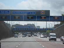
A38 road
The section from Plymouth to Exeter is known locally as the Devon Expressway; it forms the southern border of Dartmoor National Park, and serves as a southward extension of the M5 motorway opening in 1977.
[citation needed] There are several grade separated junctions along its length mainly for local traffic; including a three-level stacked roundabout for the A386, which heads out towards Dartmoor National Park.
[7] In the early 1990s, the Marsh Mills junction was significantly remodelled, reducing the size of the roundabout and building a flyover over the top of it, allowing free flowing access from the Plympton bypass onto the Parkway.
The viaducts carrying the A38 over the River Plym, which after the construction of the Marsh Mills flyover became the Exeter bound sliproads, were built in 1969–70 as part of the Plympton bypass.
[6] This section is of a poor quality when compared to the majority of the route between Exeter and Plymouth, containing several side turnings with short exit/entry slips, and properties which back onto the road.
For nearly 4 miles (6.4 km), the A38 forms part of Derby's outer ring road, including three roundabouts: Kingsway (or Grand Canyon) for the A5111; Markeaton for the A52; and Little Eaton (or Abbey Hill) for the A61 and B6179.
Originally terminating in Derby at the junction of Babington Lane with St Peter's Street (formerly the A6), the road enters the district of Amber Valley where it passes Drum Hill just north of Little Eaton and is crossed at this point by the Midshires Way and Centenary Way.
This section has a grade separated junction with the B600 for Somercotes and the Cotes Park industrial estate, and where it crosses the Nottingham spur of the Midland Main Line it enters the district of Bolsover.
Into Nottinghamshire, the road bypasses Sutton-in-Ashfield, dropping to a single carriageway configuration of 1980s construction, including multiple traffic light controlled junctions – such as the Mansfield, Ashfield Regeneration Route ("MARR").
[21][22] In a separate improvement within the Glynn Valley, the Highways Agency stabilised a 840-metre (0.52 mi) section of the road near Bodmin Parkway railway station.
The work, which commenced in October 2007, was carried out to shore up the verge, which had been built on an embankment supported by dry stone walling and the root systems of large trees.
[6] The Parkway, the section of dual carriageway through the suburbs of Plymouth between the Tamar Bridge and Marsh Mills, was constructed in 1983–84, along a route which had been reserved for this road since 1943.
[6] The Plympton bypass opened in 1971,[24] and was used for a stage in the 1974 Tour de France, with a 3.5 miles (5.6 km) stretch closed to traffic in order to allow the visit of the race to the United Kingdom.
[25][26] The viaducts carrying the A38 over the River Plym, which after the construction of the Marsh Mills flyover became the Exeter bound sliproads, were built in 1969–1970 as part of the Plympton bypass.
Beyond Highbridge and junction 22, the road departs the motorway and resumes primary status, going through Winscombe, Churchill and Lower Langford where it crosses the A368 between Weston-super-Mare and Bath.
[33] The route south of the city, despite serving the airport, is single-carriageway and suffers from heavy volume of traffic at peak times, and congestion along Bedminster Down.
Beyond the ring road, it runs as dual-carriageway past Filton Airport which lies in South Gloucestershire, which contains bases for Royal Mail, Airbus, Rolls-Royce and others.
[1] The previous main route out of Bristol (one of twelve roads from the city, turnpiked in 1727) was Stapleton and Hambrook to the upper end of Tytherington and thence to Stone.
A short distance north of where the old A38 (now declassified) joins the Bromsgrove bypass, is Lickey End, where an old highway intersection has been replaced by junction 1 of M42 motorway.
After the M5 was constructed, all traffic was diverted along Halesowen Road (then the A459) which was widened and lit to provide a direct route for the A38 to meet the M5 at Junction 4 at Lydiate Ash, with the dual carriageway continuing North to Rubery.
The city centre section takes a novel line, laid out as part of extensive reconstruction works in the 1960s, and is one of the few remaining pieces of the original "concrete collar" inner ring road.
Between exiting the city centre and the M6 junction 6 ("Spaghetti Junction") at Salford (on the border between Aston and Erdington), the modern route follows the A38(M) Aston Expressway, an unusual seven-lane, single carriageway (and speed limited to 50 mph (80 km/h)) urban motorway which uses an electronic signage-controlled tidal flow system to provide three lanes each way off-peak, and a 4/2 lane split at peak times (prioritising citybound traffic in the morning, and outbound traffic at night).
This passes far to the east of its namesake town, as well as many other north Birmingham suburbs from Erdington through to Four Oaks, requiring an extensive diversion and use of redesignated link roads to access.
Along the way, it has large roundabout interchanges with the A453 (Sutton-Tamworth, locally) and A5 roads, the latter having been upgraded with a free-flow underpass for the A38 to ease congestion, in concert with the former A5 through Hints being superseded by a dual carriageway bypass starting at the A38.
In Erdington and Sutton Coldfield, the original A5127 has been bypassed a second time by more minor urban relief roads, easing congestion in and allowing partial pedestrianisation of their respective town centre shopping areas.
A further bypass between Sutton centre and the northern junction with the A453 Tamworth Road has long been under consideration to remove pressure from the narrow, mediaeval "high street" section (that features a pair of historic coaching inns and was, originally, part of the A38), but no actual plans have yet been confirmed even after many decades of discussion.
The bypass has been effectively slightly downgraded as a result, first with the at-grade, signalised roundabouts of junction T3 interrupting traffic flow, and soon after by the imposition of a 60 mph (97 km/h), SPECS-enforced average speed limit (ostensibly because of a substandard alignment – parts of the southbound carriageway were formed directly from the old A446 – and in order to discourage illegal car and motorcycle racing)[citation needed] on the A453-to-A5 section, making the toll road a slightly faster option even during off-peak hours.
The further section of the route was improved to dual carriageway standard, including the £350,000, 2.5 miles (4.0 km) section from Barton Turn (near Barton-under-Needwood) to Branston in February 1964, bypassing Burton upon Trent in June 1967 (costing £2.6 million (£59.6 million in 2023),[54]), which stretched from Branston to Clay Mills and actually shortened the route – now the A5121 – by 1 mile (1.6 km)), and in recent years many of the at-grade junctions have been upgraded or stopped-up.
This long stretch of road closely follows Ryknild Street (whose destination was the Roman fort at Little Chester) until just short of Branston where A38 swings west, perhaps to avoid low ground.
The alignment of this road is relatively modern as the dangerous junction with Berristow Lane was improved to grade-separated in the late 1990s, incorporating access to a busy shopping centre.