Thames Path
The river is tidal downstream from Teddington Lock and the lower parts of these paths may be underwater if there is a particularly high tide, although the Thames Barrier protects London from catastrophic flooding.
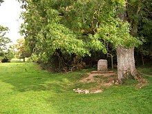
The Thames Path starts beside the monument for the traditional river source and follows the water down the hill towards the Fosse Way.
The path next follows country lanes, a short stretch along a backwater to Hannington Bridge then goes across fields to Inglesham.
[10] Above Inglesham the river is not dredged and being without weirs to control water levels, it is often shallow, weedy and swift but after heavy rain flooding of the riverside paths is common.
[15] Today, between the canal entrance and Putney Bridge, the towpath still allows access by foot to at least one side of the river for almost the whole length of the main navigation of the river, but not mill streams, backwaters or a few meanders cut off by lock cuttings, since towpaths were originally only intended to enable towing of barges on the navigation.
The Thames has been used for navigation for a long time,[12] although owners of weirs, locks and towpath often charged tolls.
3. c. 106)[16] to purchase land for a continuous horse path that the non-tidal navigation (and hence the towpath) was consolidated as a complete route under a single (toll charging) authority, upstream to Inglesham.
The commissioners had to create horse ferries to join up sections of towpath (for example at Purley Hall), as the act did not allow them to compulsorily purchase land near an existing house, garden or orchard.
The City of London Corporation, who had rights and responsibilities for the Thames below Staines from a point marked by the London Stone, had similarly bought out the towpath tolls of riparian land owners as enabled by the earlier Thames Navigation Act 1776 (17 Geo.
[12] From the 1840s, the development of the railways and steam power gradually made redundant the need for horse-drawn barges on the non-tidal Thames, although people were still using the towpath to tow small pleasure boats in 1889.
At both these weirs, lengthy rope winches were required for barges to pass Marlow and Whitchurch in the days before steam power.
It is also required to divert around Oxford Cruisers downstream of Pinkhill Lock, even though the towpath is still shown as a public right of way on Ordnance Survey maps.
The first is a short section of path on the north bank opposite Purley-on-Thames; this is still shown on Ordnance Survey maps but is inaccessible except by boat, caused by the lack of two ferries formerly diverting around Purley Hall.
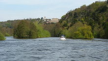
[21] The second and furthest downstream is a particularly picturesque section of towpath (again shown on OS maps) within the National Trust grounds of Cliveden; here the lack of three ferries accounts for the Thames path's diversion from the river at Cookham.
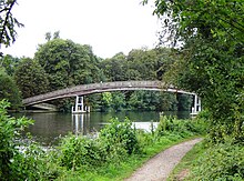
[26] In recent times, crossings have been created for the Thames Path; the Shepperton to Weybridge Ferry was restarted in 1986, Temple Footbridge near Hurley was built in 1989, a footpath was attached to Bourne End Railway Bridge in 1992 (the ferry was upstream),[27] and Bloomers Hole Footbridge was built in 2000.
Any public footpaths that cross or go along any of the other small islands formed by construction of the Thames locks only allow access to the path alone.
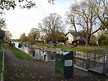
Lock building by the Thames Commissioners had improved the whole river navigation from Inglesham to the upper limit of the tidal reach at Staines by 1789.
On the tidal Thames below Staines, six new locks were built by the City of London Corporation to improve the navigation between 1811 and 1815.
Falling income from river traffic and disputes over the construction of Victoria Embankment because of Crown Estate ownership of the tidal riverbed[32] led to the City of London's seceding management of their part of the river to the Thames Conservancy in 1857; and the section below Teddington was further passed on to the Port of London Authority in 1908.
Construction of riverside buildings and structures often meant embanking the tidal Thames and acquiring riverbed ownership.
The historical progression of so many construction works, is why there is not continuous foreshore access for a riverside path within the Port of London.