A57 road
It runs east from Liverpool to Lincoln via Warrington, Salford and Manchester, and then through the Pennines over the Snake Pass (between the high moorlands of Bleaklow and Kinder Scout), around the Ladybower Reservoir, through Sheffield and past Worksop.
The connecting roads Moorfields and Hatton Garden are also part of the A57, which join the east and west directions.
It overlaps briefly with the A580 as Islington, separated as two one-way roads, then becomes Prescot Street, passing the Royal Liverpool University Hospital.
It crosses a railway at Fairfield passing St Anne's Church on the left, overlapping with the B5189 Green Lane to the north.
At Lingley Green it enters as Liverpool Road, passing the Trigger Pond pub on the left.
At the end of the dual-carriageway is a left turn for the B5212 for Glazebrook and its railway station, and then it crosses Glaze Brook] as Liverpool Road, entering the metropolitan district of Salford.
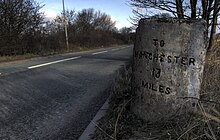
There is a new roundabout with the former road through Cadishead, and a new section of the A57 follows the Manchester Ship Canal, on the route of the MSC Railway.
It passes under the railway near the junction of the River Mersey and Manchester Ship Canal, and there is a left turn for the B5311.
At Peel Green, it meets the M60 at junction 11, with the Barton High Level Bridge and Barton-upon-Irwell close by to the south.
Before long it enters the centre of Eccles proper, splitting into two as Church Street and Irwell Place going east, passing the library and a Morrisons, and Corporation Road going west.
In Weaste, there is the Langworthy tram stop near the A5186 left turn where the Metrolink leaves the road to the south.
It meets the M60 at junction 24, and divides into two east and west routes next to Denton railway station on the left and a Sainsbury's on the right, either side of the M67.
It crosses the Peak Forest Canal and goes under the Hope Valley Line near Hyde Central railway station.
The A6016 leaves to the right and the road enters Glossop as High Street West passing a Tesco on the left.
It climbs up Holden Clough and at Featherbed Moss, it is crossed by the Pennine Way at the summit at 1550 ft, with the hills of Bleaklow to the left and Kinder Scout to the right.
It follows the River Ashop closely to the north in the Woodlands Valley for about 4 miles (6.4 km), and leaves the High Peak Estate.
It becomes Broad Lane in Netherthorpe, passing the former Jessop Hospital and then St George's Church in Portobello (now part of Sheffield University).
It becomes West Bar, passing the Law Courts on the left, then the police headquarters and former Castle Market on the right as Bridge Street.
At Bowden Housteads Woods, it leaves to the right at a GSJ, passing Athelstan Primary School becoming single-carriageway (three lanes).
The next short section is dual-carriageway to the Shireoaks roundabout, which also has access to the Gateford and Dukeries industrial estates.
The next short section, overlapping with the A60 and crossing the River Ryton, is dual-carriageway to the roundabout with the A60 (for Mansfield) and B6024, near the Shell Dukeries Garage and the Worksop Little Chef.
Via the A1, it passes Elkesley (on the former route) with two 50 mph speed cameras and the Retford Gamston Airport, where it crosses the River Idle.
Prior to the A1(M) Doncaster bypass opening in August 1961, this section of the road was the A57 – the A1 (now A638) went straight through Retford.
Near to West Drayton it crosses the River Maun; this section shared with the A1 was dualled in the late 1950s, and the West Drayton Diversion was a completely new section, with the bridge over the Maun and Markham Moor roundabout, and opened in February 1957.
There are turns for East Drayton to the left and Ragnall on the right, and the power stations of Cottam and (former) High Marnham are to the north and south, with many lines of pylons following the Trent.
It goes through Dunham on Trent, where it passes the White Swan, Bridge Inn and St Oswald's Church; the width of road through the village is not suited for the volume of traffic.
On the bend at Drinsey Nook, the road briefly re-enters Nottinghamshire – the Fossdyke is the boundary.
It approaches Saxilby and crosses the Sheffield to Lincoln Line and Fossdyke, meeting the B1241, for Sturton by Stow.
It enters Lincoln as Carholme Road passing the Total Winning Post Service Station, with Carholme Golf Club to the right, then meets the B1273 Lincoln inner ring road, becoming Newland, where it passes the offices of Lincolnshire County Council on the left.
It follows the dual-carriageway Wigford Way next to Brayford Pool and the University of Lincoln, over the River Witham, where it meets the B1262 High Street.