A82 road
Several travel guides have praised individual parts of the road, such as the section from Tyndrum to Glencoe across Rannoch Moor, as providing memorable driving experiences.
Tourists find the A82 a popular route because of its scenery, and it serves as a main artery for commercial and heavy goods traffic.
Some sections are occasionally closed for maintenance, which has resulted in strong protest from the local community, and the road has been criticised for its poor accident record.
[3] Initial sections of the road were built by General George Wade from 1724 onwards, though much of the current route was constructed by Thomas Telford in the 19th century.
[7] The main length of the A82, as managed by Transport Scotland, is now described in statutory instruments and orders as the "Dalnottar – Inverness Trunk Road".
In 2003, the Scottish Government announced that it would install bilingual signs on a number of trunk roads, including the A82 from Tarbet to Inverness.
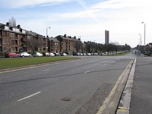
[15] It approaches a freeflow junction with the A898 from Erskine Bridge and becomes a high quality dual carriageway route through Dumbarton before running to the west of Alexandria and Bonhill on a bypass constructed in the late 1960s.
The road was widened in 2015 as part of a £9 million improvement programme, including a new viaduct bringing the carriageway width to modern standards.
[25] The north end of the loch is at Ardlui, after which the A82 continues to follow the Highland Line along Glen Falloch, a typical glacial valley, towards Crianlarich.
[29] The road climbs across the moor and reaches a peak height of 348 metres (1,142 ft) near Beinn Chaorach, the highest overall point on the A82.
The Guardian's Simon Warren described it as "the most beautiful and spectacular location in the whole of Britain",[32] though recent concern has been raised over the proliferation of tourist traffic.
This section was the location for several outdoor shots in Monty Python and the Holy Grail, including the "Gorge of Eternal Peril" scene.
[31] The modern A82 splits from Telford's route just before the Clachaig Inn, a popular location for tourists due to its proximity to the site of the Massacre of Glencoe, as noted by a sign in the reception that reads, "No hawkers or Campbells".
[39] A bearing failure on one of the supports caused delays while the rest of the structure was examined to confirm its safety, and it eventually opened in December 1975.
"[41] After passing through North Ballachulish and Onich the A82 turns to run northward along the Great Glen, which it continues to do for the remainder of the route up to Inverness.
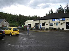
Various hotels and bed and breakfasts are situated along the road approaching Fort William, indicating the area's esteem of tourism.
[45] The A82 continues along the general line of Wade's Military Road up to Fort Augustus, crossing the canal at a swing bridge next to the locks in the village.
[46] The final 36 miles (58 km) from Fort Augustus to Inverness is mostly on the alignment of Telford's Road, running along the western shore of Loch Ness.
[47][48] This is on the opposite side of the loch to Wade's Military Road, because Telford wanted to connect the various communities along the western shore.
[47][55] Between Invermoriston and Drumnadrochit, there is a roadside memorial to John Cobb, who was killed on the loch attempting to beat the water speed record.
[57] The A82 continues at the north end of the loch, along the western edge of the River Ness, which runs parallel alongside the canal towards Inverness city centre.
It crosses the Ness at the Friar's Bridge, bypassing the city centre to pass through the docklands and associated industrial estates as an urban dual carriageway.
[59] The renovations of the early 20th century were part of a wider road building programme (an economic stimulus) after the Great Depression.
On 16 May 1934, the Ministry of Transport announced they would divert the A82 along this road, principally because it was an all-day route while the ferry at that time closed daily between 8 p.m. and 8 a.m. and cost up to five shillings to use.
The population of the area served around the A82 corridor is expected to decline from 78,900 in 2001 to 72,300 by 2018, with the vast majority of depopulation to occur in the Western Isles.
[82] In 2017, Member of the Scottish Parliament David Stewart criticised the A82's safety record in Inverness after a man was killed after being hit by a car on the road.
[23] Because most of the A82 is single carriageway, and the local geography means a detour can be a significant distance, there is a history of strong protest about closing the road.
[90] In April 2013, Transport Scotland announced further plans to close the A82 at Onich for resurfacing, but they postponed the work due to an adverse reaction from local business owners.
[95] In 1996, Transport Scotland set up a number of vehicle activated warning signs alerting drivers attention to nearby deer.
[96] The A82 has a wide variety of junctions along its length, ranging from high-quality grade-separated interchanges near Glasgow, to simple T-junctions in the Scottish Highlands.