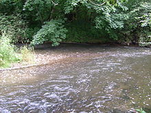
Ablach (Danube)
It rises on the European Watershed, which is only a hint in this area, from the Mindersdorfer Aach in the municipality of Hohenfels in the Landkreis of Konstanz.
After Krauchenwies, it flows in a graded bed past Zielfingen, amidst a collection of water-filled gravel pits.
This effectively moved the European watershed, annexing the upper Ablach into the catchment area of the Rhine.
[2] People settled early in the fertile lands bordering the Ablach, in which traces of Celtic, Roman and Alamanni villages have been found.
[7] Later the Ablach Valley gained importance because of its supply of wood and because the soil quality made it suitable for growing cereal.
A few kilometers of the headwaters have been diverted into the Stockacher Aach, reducing the catchment area of the Ablach by about 20 square kilometres (7.7 sq mi).
Road construction and the alteration of the habitat for agricultural purposes gave the landscape in the valley its current shape.
The section of the Ablach between Menningen and Göggingen was improved after repeated flooding; in 1910 it was widened to 12 metres (39 ft), at a cost of 150000gold marks.
[10] On the Schwackereute Plateau, the European Watershed is visually marked by a sculpture called the Wasserscheide-Plastik by Peter Klink, erected in 2007.

