Alewife station
The station has a single underground island platform, with a busway and glass-roofed fare lobby inside the parking garage.
A three-track underground yard extends about one-third mile (0.5 km) northwest past the station for use as layup tracks and overnight storage.
[3] A five-story, 2,733-space parking garage is located just west of the station platform, with vehicle entrance and exit at its northwest side.
[8] East of the garage, the concourse widens into an atrium covered with a glass pyramid, with faregates and access to the platform on the north side.
A third bike cage is located on the south side of the glass pyramid, under escalators connecting the atrium to the garage levels.
[15]: 249, 286 In 1926–27, the B&M built two new sections of track; these allowed the Lexington Branch and the Central Massachusetts Railroad to use the Fitchburg mainline east of West Cambridge.
[1] By 1922, the Boston Elevated Railway believed that Harvard would be the permanent terminus of the Cambridge–Dorchester line; the heavy ridership from the north was expected to be handled by extending rapid transit from Lechmere Square.
[21] A northwards extension from Harvard to the North Cambridge/Arlington border was proposed by Cambridge mayor John D. Lynch in 1933 and by then-freshmen state representative Tip O'Neill in 1936, but was not pursued.
[22] The 1945 Coolidge Commission report – the first major transit planning initiative in the region since 1926 – recommended an extension from Harvard to Arlington Heights via East Watertown.
[6]: I-5 By then, highway plans called for the Concord Turnpike (Route 2) to be expanded to eight lanes and extended east along the Fitchburg Line right-of-way to the proposed Inner Belt Expressway.
[6]: I-4 This placed increased pressure on a Red Line extension at least as far as a park-and-ride station at Alewife Brook Parkway to handle Route 2 traffic.
I–2 Intended primarily as a park-and-ride facility for suburban commuters, Alewife station was built on a former brickyard adjacent to the terminus of the expressway portion of Route 2.
[7][29][6]: VI-28 Although largely away from residential and commercial areas, the station was intended to be walkable from East Arlington and North Cambridge.
[32] By the time the Red Line Northwest Extension began construction in 1978, opposition in Arlington and reductions in federal funding had caused the MBTA to choose a shorter alternative with Alewife as the terminus.
[35]: 11 On January 12, 1981, construction worker Ulysses Lemon was killed in a tank truck explosion on Harvey Street in North Cambridge.
[37] The design and construction of roadway improvements trailed that of the Red Line project, complicated by political controversy between Arlington, Belmont, and Cambridge over traffic concerns.
[41] The $3.5 million project was approved by the MBTA board in June 1985; construction began that September and was completed about a year later.
[42][43] Prior to the construction of Alewife station, the surrounding area was known as the "industrial triangle"; the only nearby development was the 1971-built Rindge Towers.
[44] Developers were attracted to the Alewife area by the large plots of available land, the subway connection to Cambridge and Boston, and the proximity to Route 2.
[61] On February 4, 2023, a driver crashed their car into an edge barrier of the upper level of the parking garage, causing a 10,000-pound (4,500 kg) piece of concrete to fall onto the glass ceiling of the west fare lobby.
[67] The MBTA issued a request for proposals in August 2024 for a private developer to demolish the garage and construct new buildings in its place.
[68][69] This may also include redevelopment of about 20 acres (8.1 ha) on the north side of the Fitchburg Line west of Alewife Brook Parkway, which is occupied by a commuter rail maintenance facility that will be moved to Iron Horse Park in Billerica.
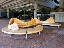
[35]: 4 They were largely constructed of durable materials like stone and metal, designed to withstand vandalism as well as normal wear and tear for 75 years.