Anthony Henday Drive
It is a heavily travelled commuter and truck bypass route with the southwest quadrant serving as a portion of the CANAMEX Corridor that links Canada to the United States and Mexico.
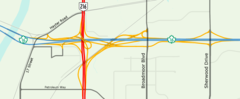
Rush hour congestion is common on the four-lane section in southwest Edmonton, where traffic levels have risen due to rapid suburban development.
Constructed over 26 years at a cost of $4.3 billion, Henday became the first freeway to surround a major Canadian city when the final segment opened on October 1, 2016.
[7] The road travels primarily through suburban residential areas in the south and west of the city, and rural farm lands and wetlands in the north.
[10] Alberta Transportation considers the starting point of Anthony Henday Drive to be at Calgary Trail / Gateway Boulevard in south Edmonton, with mileage increasing clockwise around the ring.
Curving slightly to the southwest through the suburbs of south Edmonton, Henday crosses Whitemud Creek to an interchange at Rabbit Hill Road.
Veering back to the northwest, the freeway passes beneath Terwillegar Drive before descending to cross the North Saskatchewan River on twin 360-metre (1,180 ft) bridges.
Henday continues north to major interchanges at Stony Plain Road and Yellowhead Trail, providing access to Spruce Grove and Jasper respectively, before curving northeast toward the city of St.
[7] After Manning Drive, the freeway widens to six lanes and continues clockwise through northeast Edmonton past 153 Avenue to a second crossing of the North Saskatchewan River.
[7] South of Sherwood Park Freeway, Anthony Henday Drive forms the boundary between Strathcona County and the city of Edmonton.
The freeway continues to a second interchange at Whitemud Drive after which it is briefly concurrent with Highway 14 until that route branches southeast 2 km (1.2 mi) later.
[22] Anthony Henday Drive features several variations of the combination interchange, a common name for hybrid designs that allow for high speed left turns on elevated or depressed directional ramps.
[24][25] Anthony Henday Drive's junction with the Yellowhead Highway east of Edmonton was reconstructed with two new two semi-directional flyovers and one loop ramp for the eastbound to northbound movement.
[5] The 4-lane section of the southwest quadrant between Calgary Trail and Whitemud Drive is significantly over capacity and sees major delays during peak periods.
[27] A contributing factor is the close proximity of interchanges between the North Saskatchewan River and Yellowhead Trail, which creates a problem known as "weaving" in which traffic is trying to simultaneously enter and exit within the same stretch of roadway.
[10][28] as of 2019[update] it carries over 80,000 vehicles per day in the vicinity of 111 Street,[5] and Alberta committed to widening the section to six lanes by 2022 with work planned to have begun in fall 2019.
[29][28] Prior to the announcement, project manager Bill van der Meer had stated that Henday is operating efficiently, aside from peak hour congestion.
[32] The road is named after Isle of Wight explorer Anthony Henday, who travelled up the North Saskatchewan River to the area now known as Edmonton in the 18th century on a mission for the Hudson's Bay Company.
[36] Shortly thereafter, in addition to the Restricted Development Areas that had already been retained, the Alberta government led by Premier Peter Lougheed continued land acquisitions to assemble a transportation utility corridor (TUC) for Edmonton and Calgary ring roads.
[12]: 14 Unused land within the corridor may be leased out by the government as a source of revenue,[39] but some landowners were unhappy that the province did not have a firm timeline for Henday's construction.
[41] It was deemed to be the highest priority for construction because of its designation as part of the CANAMEX Corridor, a trade route through Alberta that links Alaska to Mexico.
The new segment included 24 bridge structures and 5 interchanges, and connected Highway 14 to Yellowhead Trail in the west effectively creating a full southern bypass of Edmonton.
[49] Construction of an interim segment from Yellowhead Trail in the west to 137 Avenue was the first to be completed, as part of St. Albert's Ray Gibbon Drive project.
Full work on the entire 21 km (13 mi) of the northwest leg from Yellowhead Trail to Manning Drive (Highway 15) was initiated in early 2008 after Alberta's signing of a $1.42 billion P3 agreement with Northwestconnect General Partnership to build and maintain the road for 30 years.
[50] Construction began in September 2008, described by then Premier Ed Stelmach as "an important step in meeting our provincial goal of completing the ring roads to a freeway status by 2015.
[67] In 2015, city councillor Michael Oshry had stated that he was unhappy with the way the road was initially constructed, and Alberta should have done a better job of anticipating the rapid growth in southwest Edmonton.
[10] Project manager Bill van der Meer disagreed, saying, "If we built a six-lane divided road that was virtually empty for 10 years, that wouldn't be money well spent.
Alberta proposes to construct a second ring road around Edmonton to support future growth, approximately 8 km (5 mi) beyond Anthony Henday Drive.
Parkland County mayor Rod Shaigec voiced his support for the plan in 2014, stating, "if we don't implement and have another ring road, it's going to be further traffic congestion and have environmental impacts as well.
[78] In May 2017, Edmonton Police Chief Rod Knecht expressed his support for an increase in the speed limit on Anthony Henday Drive from 100 km/h to 110 km/h (68 mph).