Kincardine (Ardgay and District)
[2] As a civil parish named “Kincardine” it is a unit for various statistical, census, registration and record purposes, while, as “Ardgay and District”, it functions as a community council.
Ardgay derives from the Gaelic words “ard” and “gaoith”, meaning windy height.
The Oykel arises in the north-west corner at a height of 1,500 ft. from whence it flows 35 miles to the sea, first southward via Loch Ailsh, then east-south-eastwards until it becomes the estuary of the Kyle of Sutherland.
The land is mostly hilly with several significant peaks, several on its borders, namely Cnoc Leathad na Siorramachd (1845 ft.), Càrn Chuinneag (2749 ft.) and Breabag (2338 ft.).
[15] The Clan Ross were the inhabitants of the district and, even in the 19th century, they still owned three quarters of the property in the parish and were by much the most prevalent surname.
[4] The Battle of Carbisdale or Invercarron took place near the present Culrain station, 4 miles north-west of Ardgay, in 1650, when the Royalist Marquess of Montrose was defeated by the Covenanter forces led by Archibald Strachan, fighting for the Scottish government.
[16] Sir George Mackenzie's Ross-shire estates were transferred to Cromartyshire by a 1685 Act of Parliament (repealed 1686, re-enacted 1690).
As a result, 7,025 acres of the parish, representing 4.5% of the total, were henceforth in the county of Cromartyshire, before its amalgamation with Ross-shire in 1889.
[17] Sheep farming was first introduced into the parish by Sir John Lockhart-Ross in the 1760s or 1770s, which would presage the later decline in population.
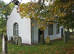
[19] Prior to the establishment of Croick Church, additional religious services were held at Amat in Strathcarron and Doune in Strath Oykel.
James Gillander, factor to Charles Robertson of Kindeace, evicted 18 families (92 people) from Glencalvie, 3 miles south of Croick, to create a sheep farm.
In 1840 the Kirk Session had 7 members including the minister, with the Kincardine school master acting as clerk.
[10] The Parochial Board of Kincardine was established in 1845,[22][23] being composed of the Heritors of the parish, the Kirk Sessions, and some elected members.
As Kincardine raised a property tax(“Rate”), from mid 1845, in accordance with the Act, three elected members were included in the board.
(Scotland) Act 1994, Sutherland District was abolished in 1996 and subsumed in the Highland Unitary Authority, which acquired responsibility for community councils.