Atlantic hurricane season
Historical delineations of the Atlantic hurricane season varied but generally covered some part of the estival (summer) and autumnal months.
[7][6] In the second volume of Voyages and Descriptions (published in 1700), English explorer and naturalist William Dampier observed that hurricanes in the Caribbean Sea were expected in July, August, and September.
[8] Mariners in the 18th century generally regarded the period from July to the end of October as the "hurricane season" based on the frequency of storms striking the Caribbean islands and the trajectories of ships traversing the Atlantic.
[9][7] The hurricane season was also an important influence on European naval operations within the West Indies, forcing the movement of materiel to be expedited before its onset or delayed until its end.
[6][15] Based on a catalog of 355 storms between 1493–1855 in the North Atlantic compiled by M. André Poëy, W. H. Rosser described the months of July, August, September, and October as comprising the "true hurricane season of the West Indies" in his 1876 book The Law of Storms Considered Practically.
[18][19][20] By 1907, these stations in the West Indies operated within a hurricane season defined as beginning on June 15 and ending on November 15.
Weather Bureau's observing networks in the Caribbean region led to these stations reporting twice daily during a hurricane season expanded to cover the June 1 to November 30 period.
[30][31] This was when hurricane reconnaissance planes were sent out to fly across the Atlantic and Gulf of Mexico on a routine basis to look for potential tropical cyclones, in the years before the continuous weather satellite era.
While this definition was chosen in part to make it easier for the public to remember the timing of hurricanes, storms have often formed outside the official seasonal bounds.
[36] In response, the NHC formed a team to develop quantiative criteria to evaluate extending the seasonal bounds.
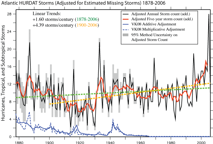
The original database of six-hourly positions and intensities was put together in the 1960s in support of the Apollo space program to help provide statistical track forecast guidance.
In the intervening years, this database – which is now freely and easily accessible on the Internet from the National Hurricane Center's (NHC) webpage – has been utilized for a wide variety of uses: climatic change studies, seasonal forecasting, risk assessment for county emergency managers, analysis of potential losses for insurance and business interests, intensity forecasting techniques and verification of official and various model predictions of track and intensity.
Additionally, analysis techniques have changed over the years at NHC as their understanding of tropical cyclones has developed, leading to biases in the historical database.
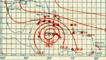
Recent efforts into uncovering undocumented historical hurricanes in the late 19th and 20th centuries by various researchers have greatly increased our knowledge of these past events.
The synoptic concurrence of AEWs in driving the dynamics of the Sahel greening also appears to increase tropical cyclogenesis over the North Atlantic.