Auburn, Kansas
[3] In July 1854, John W. Brown came to this area and found it highly suitable for a homestead.
In 1856, Mr. Brown, along with M. C. Dickey, Loring Farnsworth and Henry Fox pre-empted 320 acres (1.3 km2) for the purpose of a town.
It was located on the California Road and work began at once on the many buildings needed in a town of Brownville's size.
Two daily stage lines brought mail and people to the town and business was very good.
He originally served as a missionary among the Pottawatomie Indians in Michigan Territory, while he apprenticed to a blacksmith and attended school at night.
In a three-story stone building with twelve rooms, boys and girls were given instruction in the manual arts, as well as in reading, writing, arithmetic, and religious subjects.
In the fall of 1854, Simmerwell and his wife had retired from active work in the Pottawatomie Mission, to homestead on 160 acres (0.6 km2) southwest of the town.
[citation needed] In the 1850s, the city grew rapidly and was often referred to as a "boom town".
Topeka was chosen to be the capital because it had the railroad and an important ferry site along the Kansas River.
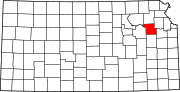
[citation needed] A description of the town from a 1912 volume of Kansas: A Cyclopedia of State History is as follows: Auburn, a money order post office of Shawnee county, is in the township of the same name, about 15 miles (24 km) southwest of Topeka and 8 miles (13 km) west of Wakarusa, which is the nearest railroad station.
It is a trading center for that section of the county, has Baptist, Methodist and Presbyterian churches, telephone connection with Topeka and other adjacent points, and in 1910 reported a population of 72.
Two rural free delivery routes start from the Auburn office and supply daily mail to the farmers of the vicinity.
[citation needed] In the 1960s and 1970s, the city's population shrank, but was re-vitalized with large housing projects.
[citation needed] Most Auburn residents commute to other surrounding cities for work, often Topeka.
[5] According to the United States Census Bureau, the city has a total area of 0.64 square miles (1.66 km2), all land.
[6] The climate in this area is characterized by hot, humid summers and generally mild to cool winters.
The 2020 United States census counted 1,273 people, 483 households, and 331 families in Auburn.
Though Auburn is less than a mile northwest of the Kansas Turnpike, the nearest exit is located northeast in Topeka.