Barrigada, Guam
From 2 to 4 August 1944, the United States Marine Corps engaged troops from the Empire of Japan at present-day Barrigada Heights during the battle of Guam, a year before the end of the Second World War.
[7] North of Routes 8 and 16 is the former Naval Air Station Agana, most of which lies within the boundary of Barrigada.
Won Pat International Airport; (IATA: GUM, ICAO: PGUM)) was closed in the mid-1990s, the land and buildings were handed over to the Government of Guam, which utilized many former base buildings as government offices; some agencies, such as the Guam Department of Revenue and Taxation, have since moved elsewhere.
Most of the original NAS housing facilities have been demolished to make room for airport-related commercial buildings.
The closing of NAS Agana resulted in the opening of Central Avenue and Sunset Boulevard on the north side of the runways to the general public.
This busy, but yet unnumbered highway offers a shortcut from Barrigada to Tamuning and Tumon, Guam's economic center.
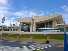
[17] The Federal Aviation Administration operates the Guam Air Route Traffic Control Center at 1775, Admiral Sherman Boulevard in Tiyan.
This office provides services to Guam, the Commonwealth of the Northern Mariana Islands, and U.S.-affiliated Federated States of Micronesia.