Bathampton
Bathampton (/bɑːθˈæmptən, bæθ-/) is a village and civil parish 2 miles (3 km) east of Bath, England on the south bank of the River Avon.
Bathampton Camp is a univallate Iron Age hill fort situated approximately 2 miles (3.2 km) east from the village.
The parish council's role also includes initiating projects for the maintenance and repair of parish facilities, such as the village hall or community centre, playing fields and playgrounds, as well as consulting with the district council on the maintenance, repair, and improvement of highways, drainage, footpaths, public transport, and street cleaning.
The parish falls within the unitary authority of Bath and North East Somerset which was created in 1996, as established by the Local Government Act 1992.
[7] The parish is represented in the House of Commons of the Parliament of the United Kingdom as part of the Bath constituency.
Until the late 1950s the track used for bringing stone down into the valley could be seen; it crossed the main A36 road over a short rock bridge known as the Dry Arch.
[8] at OS Grid Ref ST778651 (51°23.0′N 2°19.1′W / 51.3833°N 2.3183°W / 51.3833; -2.3183) When the A46 Bathampton by-pass was built, an area of 9 hectares was created to provide additional flood relief.
Sand martin and kingfisher have been seen regularly by the oxbow, and other migrants have included yellow wagtail, whinchat and hobby.
[9] In 2009, the local Council identified the meadows as a possible new park and ride site to alleviate traffic congestion in the city.
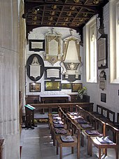
[18] Phillip was buried in the church after his death in 1814 and although it was unnoticed for many years, the grave was discovered in 1897[21] and the Premier of New South Wales, Sir Henry Parkes, had it restored.