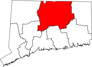
Bloomfield, Connecticut
Bloomfield is a suburb of Hartford in the Capitol Planning Region, Connecticut, United States.
Originally land of the Poquonock Native Americans, the area was first settled in 1660 as part of Windsor, organized as the Parish of Wintonbury in 1736.
[4] Initially, the town's local economy was agriculturally based, mostly in shade tobacco, remaining as such until it developed as a postwar suburb of Hartford starting in the 1950s.
While the town's southern and eastern fringes are more densely populated and developed, the northern and western sections maintain a more rural feel with meadows, woods, and some remaining farmland.
The west side of the town is flanked by Talcott Mountain, part of the Metacomet Ridge, a mountainous trap rock ridgeline that stretches from Long Island Sound to nearly the Vermont border.
Notable features of the Metacomet Ridge in Bloomfield include Penwood State Park and the Tariffville Gorge of the Farmington River, on the borders of East Granby, Simsbury, and Bloomfield.
The major east–west throughway in Bloomfield is Route 218, which starts at the Simsbury Road/Hall Boulevard split at the West Hartford line and inches north toward Cottage Grove Road before heading eastbound.
Eleven bus routes in Connecticut Transit's Hartford Division serve Bloomfield: 36, 46, 50, 52, 54, 56, 72, 74, 76, 92, and 153.