Borders of Colombia
Colombia is located in the northwestern corner of South America, confined between the vast Amazon rainforest and the Atlantic and Pacific oceans, and also crossed by the great Andes mountain range.
This unequivocal starting point was the uti possidetis iuris of 1810, which referred to the territory that the Viceroyalty of New Granada possessed in that year.
Taking the principle of uti possidetis iuris as a basis, Colombia negotiated boundaries with Venezuela, Costa Rica (when they were still bordering countries), Ecuador and Peru, while another principle was applied with Brazil: the uti possidetis de facto, according to which that country required that the border continue as far as where its nationals owned land.
[7] This border, despite its short length, runs through terrains of varied geography, including the Pacific plains, the Andean space and the Amazon.
Despite this, it was difficult to reach a layout that was convenient for both parties due to the imprecise limits set by the Spanish Empire during the colonial period, which is why the common border remained in dispute for a long time.
[12] The departments that form part of the border are La Guajira, Cesar, Norte de Santander, Boyacá, Arauca, Vichada y Guainía.
This border has been one of the most difficult to draw due to the interests of both nations on the territories it includes, on both sides of the boundary line; it is also one of those with the most social and economic problems.
[22] The Colombian-Venezuelan border is currently delimited by two treaties (the Spanish Arbitration Award of 1891 and the Treaty of 1941), although five of them have been negotiated to date:[12] Colombia is the only country in South America that has coastlines on the two largest seas in the world (the Atlantic Ocean, in its arm of the Caribbean Sea, and the Pacific Ocean, the largest in the world).
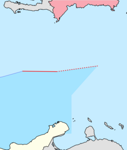
[12] The country shares borders with 7 nations in the Caribbean Sea (Costa Rica, Haiti, Honduras, Jamaica, Nicaragua, Panama and the Dominican Republic).
Some of these borders are still disputed due to the commercial and economic importance of these waters, as they contain large natural resources (such as oil and fish reserves, among others), but also because they are one of the main entrances and exits for ships in Latin America.
The border consists of the following points:[30] The delimitation of the marine and submarine spaces between both nations in the Pacific Ocean was made by means of the Gutiérrez-Lloreda Treaty, signed in Bogotá on 6 April 1984 between Carlos José Gutiérrez and Rodrigo Lloreda Caicedo, foreign ministers of Costa Rica and Colombia respectively.
The first section outlines a zone of joint administration, control, exploration and exploitation of living resources, called the Common Regime Area.
It also began to claim the Roncador, Quitasueño and Serrana cays as its own, which in that year were in dispute between Colombia and the United States and were not included in the 1928 treaty.
The ICJ ruled on 13 December 2007, stating that while the Esguerra-Bárcenas Treaty did clarify Colombia's sovereignty over the San Andrés and Providencia archipelago, it did not do the same over the Roncador, Serrana and Quitasueño cays and did not resolve the boundary between the marine and submarine areas between the two countries.