Borealis quadrangle
It was mapped in its entirety by the MESSENGER spacecraft, which orbited the planet from 2008 to 2015, excluding areas of permanent shadow near the north pole.
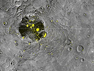
This unit covers vast expanses of Borealis Planitia, a depression about 1,000 km (620 mi) in diameter that has an irregular arcuate west boundary.
Because the terminator was a few degrees away from the 0°-180° meridian at the time of the first encounter, photographs of the region were acquired under a wide range of lighting conditions.
These conditions and the large obliquity of the photographs hampered geologic interpretation of surface materials in the map area, as they did in the Kuiper (De Hon and others, 1981), Victoria (McGill and King, 1983), and Shakespeare (Guest and Greeley, 1983) quadrangles to the south.
Its pronounced orbital eccentricity (0.2563) causes the apparent solar intensity at Mercury to vary by more than a factor of 2 throughout a Mercurian year,[8] corresponding to about a 20 percent change in equilibrium temperature.
The curve for the southeastern part of Oceanus Procellarum was obtained in an area centered near lat 2°00' N. and long 31°00'W., south of the crater Kunowsky.
However, smooth plains south of lat 65° N. in the Shakespeare quadrangle, in the crater Strindberg and in Suisei Planitia, are included in these counts.
Distinguishing one type of plains material from another by variations in roughness and crater density is highly dependent on the resolution and lighting conditions of individual Mariner frames (Schaber and McCauley, 1980).
Intermediate plains material was first recognized and mapped in the Tolstoj quadrangle (Schaber and McCauley, 1980), where it primarily occurs on the floors of craters.
Goethe is bounded on its north and east sides by a gently sloping wall and discontinuous, low, hummocky rim material that may consist of ejecta deposits.
On its west side, Goethe is bounded by at least three subparallel ridges or tilted blocks, which are separated by narrow troughs partly filled with smooth plains material.
Only the northernmost parts of the crater’s rim and interior lie within the mapped area, but the ghost remnant of an inner ring now flooded by smooth plains material is recognized (FDS 148) farther south in the Shakespeare quadrangle.
Turgenev, 110 km (68 mi) in diameter, is large enough to be a central-peak basin (Wood and Head, 1976), even though the peak ring probably has been concealed under smooth plains material.
A similar argument can be advanced for the age of the Monteverdi Basin, 130 km in diameter, centered at lat 64° N., long 77° W. in the Victoria quadrangle.
The younger craters Jókai and Verdi, which have prominent central peaks and ghostlike discontinuous inner rings, probably qualify as central-peak basins (Wood and Head, 1976).
No material similar to either the lineated or the secondary-crater facies of the Van Eyck Formation, the most distinctive and distant unit of the Caloris Group (McCauley and others, 1981), can be unambiguously identified in the Borealis region.
Another morphologic feature that may be related to the Caloris Basin event consists of grooves on intercrater plains material and on the southwest-facing walls of craters such as Mansart.
Smooth plains material (unit ps) forms the vast expanses of Borealis and Suisei Planitiae, as well as most basin and crater floors.
Wilhelms[11] even hypothesized that the source basin for material of the extensive plains of Borealis Planitia "could well be lurking in the darkness beyond the terminator."
Instead, the morphologic components of crater interiors and the abundance of central peaks and terraces on both bodies seem to be related to the physical properties of the target material[5] (Cintala and others, 1977; Smith and Hartnell, 1978).
In one type found along the northwest border of Suisei Planitia (Guest and Greeley, 1983), only the uppermost parts of walls and rims protrude above smooth plains material.
They thought that these fractures were later modified, and predicted that east-trending normal faults caused by tensional stresses would be found in the polar regions.
That these ridges, scarps, and troughs are parts of a global grid of fractures cannot be stated conclusively because of their proximity to the terminator and the lack of photographic coverage beyond the 190° meridian.
Some scarps probably were formed by normal faulting of the smooth plains material that covers some crater floors, as in the Kuiper quadrangle (Scott and others, 1980).
Melosh (1977) predicted that normal east-trending faults would form in high Mercurian latitudes as a result of slight crustal shortening.
His predicted faults may be represented by a generally east-northeast-trending scarp and a lineament that cut across intermediate plains material and the crater Jókai between the 125° and 155° meridians.
The north pole is too close to the terminator to detect the presence or absence of a "polygonal arrangement without preferred orientation," as predicted by Melosh and Dzurisin (1978, p. 233).
They appear either to outline the rim crests of subjacent ghost craters that are lightly mantled by smooth plains material or to be lava flow fronts.
Many scarps in Borealis Planitia are subconcentric to the rim of the Goethe Basin and have steeper slopes that face away from it, suggesting that they represent the fronts of lava flows that resurfaced extensive areas of heavily cratered terrain (intercrater or older plains material).
The scarps and troughs that trend across intercrater plains material may indicate an early compressional episode that followed even earlier expansion and differentiation of the crust.