Bridger Trail
At the time the region was controlled by the Sioux, Cheyenne and Arapaho, who stepped up their raids in response to the stream of settlers along the trail.
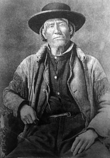
In 1864 the commandant of Fort Laramie, Colonel William O. Collins, concerned about the hostilities along the Bozeman Trail, asked Jim Bridger to lead a party of settlers from Denver on a new route to the mines through the Big Horn Basin along the western edge of the Big Horn Mountains.
[1] The road ran approximately 425 miles (684 km), paralleling the Bozeman Trail and running to the west of the Bighorn Mountains in the lands of the Crow and Shoshone people.
The route left the Oregon Trail at Red Buttes, near Fort Caspar in central Wyoming, and headed in a northwestern direction.
After cresting the range, the trail led down along the Kirby Creek drainage to where it meets the Bighorn River near the current town of Lucerne.
After traveling through Bridger Canyon, the trail met the Clark's Fork Yellowstone River and followed it downstream past the present day town of Bridger, Montana, finally joining the Bozeman Trail at its confluence with Rock Creek, about 10 miles south of present-day Laurel, Montana.