California Aqueduct
After Dos Amigos, the aqueduct flows about 95 mi (153 km) to where the Coastal Branch splits from the "main line".
After the coastal branch, the line continues by gravity another 66 mi (106 km) to the Buena Vista Pumping Plant.
South of the plant the west branch splits off in a southwesterly direction to serve the Los Angeles Basin.
[8] From its beginning until its first branch, the aqueduct passes through parts of Contra Costa, Alameda, San Joaquin, Stanislaus, Merced, Fresno, and Kings counties.
With construction beginning in 1994, Phase II consists of 101 mi (163 km) of a 42–57-inch (1.07–1.45 m) diameter buried pipeline extending from the Devils Den Pump Plant, and terminates at Tank 5 on Vandenberg Space Force Base in Santa Barbara County.
The Central Coast Water Authority (CCWA) extension, completed in 1997, is a (30–39 in) (76–99 cm) diameter pipeline that travels 42 mi (68 km) from Vandenberg through Vandenberg Village, Lompoc, Buellton, and Solvang where it terminates at Lake Cachuma in Los Padres National Forest.
West Branch facilities include[11] When it was open, the California Aqueduct Bikeway was the longest of the paved paths in the Los Angeles area, at 107 miles (172 km) long from Quail Lake near Gorman in the Sierra Pelona Mountains through the desert to Silverwood Lake in the San Bernardino Mountains.
It is expected to remain closed indefinitely due to the continued liability issues and an increased focus on security, especially after the September 11, 2001 attacks.
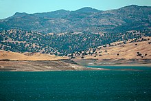
[14] In the south part of the San Joaquin Valley, the alluvial fan of the Kings River and another one from Coast Ranges streams have created a divide and resultantly the currently dry Tulare basin of the Central Valley, into which flow four major Sierra Nevada rivers, the Kings, Kaweah, Tule and Kern.
[15] The rivers of the Central Valley converge in the Sacramento-San Joaquin Delta, a complex network of marshy channels, distributaries and sloughs that wind around islands mainly used for agriculture.
Over 25 million people, living both in the valley and in other regions of the state, rely on the water carried by these rivers.
[21] Coarse-grained sediment which holds groundwater can be drained and recharged with minimal underground and surface level damage and the change that does occur is considered seasonal subsidence.
[18] Natural causes include; earthquakes, erosion, glacial movement, soil compaction and the formation of sinkholes.
[18] Groundwater use and pumping in the area was the major water use for farmers and agriculture in the 1920s, and over time, this over-pumping resulted in land subsidence and a decline in groundwater-level resources.
[23] The Tulare Basin is subsiding at a rate of about 30 cm (one foot) per year, as measured by NASA's GRACE satellite.
[24] The Central Valley, where a large portion of the California Aqueduct runs through, has been affected by the pumping of groundwater and subsequent land subsidence.
[25] Farmers in and near the Central Valley have become reliant on groundwater especially with recent droughts impacting the amount of readily accessible surface water.
[26] From October 2011 to September 2015 measurements made on groundwater levels in the San Joaquin Valley's aquifers recorded a loss of 14 km3/year, a total of 56 km3.
Capacity has been compromised due to damage to the canals and therefore has caused problems and delays with delivering the water across the state, as well as higher rates and costs for power and operation.