Buffer analysis
[3] The fundamental method to create a buffer around a geographic feature stored in a vector data model, with a given radius r is as follows:[4] Software implementations of the buffer operation typically use alterations of this strategy to process more efficiently and accurately.
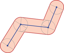
In Mathematics, GIS Buffer operation is a Minkowski Sum (or difference) of a geometry and a disk.
[5] Traditional implementations assumed the buffer was being created on a planar cartesian coordinate space (i.e., created by a map projection) using Euclidean geometry, because the mathematics and computation involved is relatively simple, which was important given the computing power available in the late 1970s.
Some current software, such as Esri ArcGIS Pro, offer the option to compute buffers using geodesic distance, using a similar algorithm but calculated using spherical trigonometry, including representing the lines between vertices as great circles.
[4] Other implementations use a workaround by first reprojecting the feature to a projection that minimizes distortion in that location, then computing the planar buffer.