Compact Reconnaissance Imaging Spectrometer for Mars
The CRISM instrument team comprised scientists from over ten universities and was led by principal investigator Scott Murchie.
In order to do this, CRISM was mapping the presence of minerals and chemicals that may indicate past interaction with water - low-temperature or hydrothermal.
In the untargeted mode, CRISM reconnoiters Mars, recording approximately 50 of its 544 measurable wavelengths at a resolution of 100 to 200 meters per pixel.
The extra time collecting data over a targeted area increases the signal-to-noise ratio as well as the spatial and spectral resolution of the image.
[6][7][8] The instrument team found that some false positives were caused by a filtering step when the detector switches from a high luminosity area to shadows.
The MER Opportunity rover spent years exploring sedimentary rocks formed in the latter environment, full of sulfates, salts, and oxidized iron minerals.
The types of soil minerals can reveal if the environment was cool or warm, wet or dry, or whether the water was fresh or salty.
Some researchers have suggested that the Martian clay "layer cake" was created by soil-forming processes, including rainfall, at the time that valley networks formed.
On Earth, the lowermost layers of deltas are called bottom set beds, and they are made of clays that settled out of inflowing river water in quiet, deep parts of the lakes.
CRISM discovered several craters on the western slope of Tharsis that contain "bathtub rings" of sulfate minerals and a kind of phyllosilicate called kaolinite.
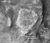
The MER Spirit rover explored a silica-rich deposit called "Home Plate" that is thought to have formed in a hot spring.
Silica has also been identified on the flanks of volcanic inside the caldera of the Syrtis Major shield volcano, forming light-colored mounds that look like scaled-up versions of Home Plate.
Elsewhere, in the westernmost parts of Valles Marineris, near the core of the Tharsis volcanic province, there are sulfate and clay deposits suggestive of "warm" springs.
If a thick atmosphere ever existed, it was either blown into space by solar wind or impacts, or reacted with silicate rocks to become trapped as carbonates in Mars' crust.
[32] Soon thereafter, landed missions to Mars started identifying carbonates on the surface; the Phoenix Mars lander found between 3–5 wt% calcite (CaCO3) at its northern lowland landing site,[33] while the MER Spirit rover identified outcrops rich in magnesium-iron carbonate (16–34 wt%) in the Columbia Hills of Gusev crater.
Images from the Mars Orbiter Camera on MGS showed that in some places the upper few kilometers of the crust is composed of hundreds of thin volcanic lava flows.
During southern summer, when Mars is closest to the Sun (at perihelion), solar heating can raise massive dust storms.
In contrast, during northern summer when Mars is furthest from the Sun (at aphelion), there is an equatorial water-ice cloud belt and very little dust in the atmosphere.
Small, suspended particles of dust and water ice - aerosols - intercept 20–30% of incoming sunlight, even under relatively clear conditions.
CRISM had taken three major kinds of measurements of dust and ice in the atmosphere: targeted observations whose repeated views of the surface provide a sensitive estimate of aerosol abundance; special global grids of targeted observations every couple of months designed especially to track spatial and seasonal variations; and scans across the planet's limb to show how dust and ice vary with height above the surface.
The south polar seasonal cap has a bizarre variety of bright and dark streaks and spots that appear during spring, as carbon dioxide ice sublimates.