[1] Ralph is a visible and infrared imager and spectrometer to provide maps of relevant astronomical targets based on data from that hardware.
[3] MVIC is a pushbroom scanner type of design with seven channels, including red, blue, near-infrared (NIR), and methane.
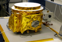
[4] Ralph is one of seven major instruments aboard New Horizons which was launched in 2006 and flew by the dwarf planet Pluto in 2015.
[8] Ralph was previously used to observe the planet Jupiter and its moons in 2006 and in 2007 when it flew-by en route out of the Solar System and past Pluto.
[14] LEISA's acronym was retitled from Linear Etalon Imaging Spectral Array to Lisa Hardaway Infrared Mapping Spectrometer by NASA in June 2017, after Ralph's program manager.
[15] Lisa Hardaway was an aerospace engineer and New Horizons Ralph instrument program manager who died in January 2017 at the age of 50.
Ralph methane detections (left) overlaid onto a
LORRI
image of dwarf planet Pluto (right)
LEISA channel data, showing its lower definition infrared image of Pluto but with recorded
infrared spectra
of the dwarf planet in false color. Two infrared spectra are shown, from the outlined regions in the global map to the left. 1 Micron is 1000 nm, and visible light is below 1 Micron.
Water ice identified on Pluto with Ralph spectral signatures of water ice from LEISA noted in blue on top of MVIC imaging
This extremely low-light image is a view of the dark side of Pluto's moon Charon, lit by starlight and Plutoshine. Ralph-MVIC channel data
Arrokoth image taken by Ralph-MVIC (January 2, 2019 release)
This image of Pluto from July 2015 flyby includes Ralph-MVIC red, blue, and NIR color data.
[
27
]
Ralph-MVIC view's a 250 miles (400 kilometers) section of Pluto on July 14, 2015
[
28
]
Attempted natural color view using only data from MVIC channel
[
29
]
An example of an image from LORRI, a view of Pluto's terrain from its 2015 flyby of the dwarf planet with Ralph-MVIC data from Red, Blue, and Near IR channels. This image is about 330 miles (530 kilometers) across