Calcasieu River
[1] Approximately 200 miles (320 km) long,[2] it drains a largely rural area of forests and bayou country, meandering southward to the Gulf of Mexico.
[3] The Calcasieu rises in Vernon Parish, north of Leesville, and flows initially southeast, passing through the Kisatchie National Forest southwest of Alexandria.
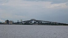
The lower portion of the river south of Lake Charles is paralleled by a navigable canal which connects to the Gulf Intracoastal Waterway.
[4][5] During the US Civil War, a naval engagement occurred on May 6, 1864 at Calcasieu Pass, with the Confederates capturing two Union gun boats.
Mother Jones reported the spill as potentially discharging between 19,000,000 and 47,000,000 pounds (8,600 and 21,300 tonnes), that would have spread throughout parts of the estuary.