Caloris Planitia
"Calor" is Latin for "heat" and the basin is so-named because the Sun is almost directly overhead every second time Mercury passes perihelion.
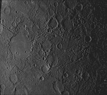
The crater, discovered in 1974, is surrounded by the Caloris Montes, a ring of mountains approximately 2 km (1.2 mi) tall.
[3] Outside the walls, material ejected in the impact which created the basin extends for 1,000 km (620 mi), and concentric rings surround the crater.
[10] This hypothetical impact is also believed to have triggered volcanic activity on Mercury, resulting in the formation of smooth plains.
Mercury has a very tenuous and transient atmosphere, containing small amounts of hydrogen and helium captured from the solar wind, as well as heavier elements such as sodium and potassium.
The Caloris basin has been found to be a significant source of sodium and potassium, indicating that the fractures created by the impact facilitate the release of gases from within the planet.