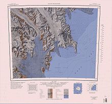
Wood Bay
[3] The Tinker Glacier Tongue extends into the bay to the east of Cape Johnson and Kay Island, and to the west of Harrow Peaks in the Random Hills.
A small island lying 2 nautical miles (3.7 km; 2.3 mi) east of Cape Johnson in the north part of Wood Bay.
A rounded, largely ice-free point lying below Mount Melbourne along the west side of Wood Bay.
Named by US-ACAN for Larry D. Edmonson, satellite geodesy scientist at McMurdo Station, winter party 1966.
A nunatak standing 1 nautical mile (1.9 km; 1.2 mi) inland from the south shore of Wood Bay, rising above the col between Cape Washington and Mount Melbourne.
[9] This article incorporates public domain material from websites or documents of the United States Geological Survey.