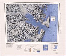
Hallett Peninsula
It was so named by the New Zealand Geological Survey Antarctic Expedition (NZGSAE), 1957–58, because Hallett Station on Seabee Hook was established at the north end of the peninsula.
Mountain, 830 metres (2,720 ft) high, with a prominent and peculiar rock scar called The Football on its north side, on the ridge between Edisto Inlet and Tucker Glacier.
Broad pass at 700 metres (2,300 ft) high, 2 nautical miles (3.7 km; 2.3 mi) east-southeast of Football Mountain on the ridge between Edisto Inlet and Tucker Glacier.
A bold rock cape that forms the south end of Hallett Peninsula and marks the north entrance to Tucker Inlet.
For the most part this crest is very close to the great 1,500 metres (4,900 ft) high Cotter Cliffs that fall abruptly to the Ross Sea.
A line of spectacular bare rock cliffs rising 1,500 metres (4,900 ft) high above the Ross Sea and forming the seaward (east) face of Hallett Peninsula.
No prominent cape exists along the east side of Hallett Peninsula, but the name Cotter has been retained for the cliffs in the same general area.
The slope must be traversed by parties moving overland from Hallett station to Tucker Glacier, after the bay ice in Edisto Inlet has broken out.
Steep glacier falling away from the west side of Hallett Peninsula and forming a floating ice tongue on the east shore of Edisto Inlet between Salmon and Roberts Cliffs.
Glacier flowing from the west side of Hallett Peninsula 1 nautical mile (1.9 km; 1.2 mi) south of Seabee Hook and forming a short, floating ice tongue on the shore of Edisto Inlet.
Low, recurved spit composed of coarse volcanic ash which projects about 0.5 nautical miles (0.93 km; 0.58 mi) west from the high rocky ridge forming Cape Hallett.
Surveyed in January 1956 by members of United States Navy Operation Deep Freeze I aboard the icebreaker USS Edisto.
Named by the US-ACAN for the Seabee unit aboard the Edisto which investigated and surveyed this area for possible use as a base site for International Geophysical Year operations.
Point marking the west side of the entrance to Willett Cove and the south end of Seabee Hook, a low recurved spit 1.5 nautical miles (2.8 km; 1.7 mi) west-southwest of Cape Hallett.
Surveyed in January 1956 by members of United States Navy Operation Deep Freeze I aboard the icebreaker USS Edisto.