Cairo–Cape Town Highway
In the 1980s, a modified version of the plan was revived as part of the Trans-African Highway, a transcontinental road network developed by the United Nations Economic Commission for Africa (UNECA), the African Development Bank (ADB), and the African Union, named the Cairo-Cape Town Highway.
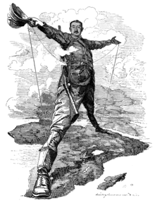
The original proposal for a North South Red Line route was made in 1874 by Edwin Arnold, then the editor of The Daily Telegraph, which was joint sponsor of the expedition by Henry Morton Stanley to Africa to discover the course of the Congo River.
[2] The proposed route involved a mixture of railway and river transport between Elizabethville in the Belgian Congo and Sennar in the Sudan rather than a full length rail line.
The road would also link some of the most important cities of Africa, including Cape Town, Johannesburg, Pretoria, Salisbury, Lusaka, Nairobi, Khartoum and Cairo.
Shortly before his death he had persuaded the German Kaiser to allow access through his colony for the Cape to Cairo telegraph line (which was built as far north as Ujiji but never completed).
After the Second World War, the British Empire disintegrated; Sudan was the next to become independent in 1956, putting an end to the colonial motivation of the dream.
[6] The first known attempt to drive a vehicle from Cape Town to Cairo was by a Captain Kelsey in 1913-14 but this came to an untimely end when he was killed by a leopard in Rhodesia.
Firstly, the Cairo–Cape Town Highway passes through Addis Ababa, Ethiopia while the Cape-to-Cairo Road goes directly through South Sudan from Kenya when heading northwards.
Secondly, in Tanzania, the Cairo–Cape Town Highway passes as the shortcut through Dodoma and Babati (The T5) when travelling from Iringa to Arusha and not as the longer route through Chalinze.
Thirdly, the Cairo–Cape Town Highway passes through Livingstone (Victoria Falls), Bulawayo, Francistown and Gaborone and not through Harare, Pretoria and Johannesburg.
In Tanzania there are a number of roads could be deemed to be part of the route; the clear definitions and markings that are characteristic of the Pan-African Highway do not apply here.
[11][12] The route from Isiolo in Kenya to Moyale on the Ethiopian border through the northern Kenyan desert has sometimes been dangerous due to bandits, but is now paved.
[13][14] The most difficult section in the whole Cape to Cairo journey was across the Nubian Desert in northern Sudan between Atbara and Wadi Halfa, but this has been bypassed by a paved road on the west side of the Nile, Dongola to Abu Simbel Junction to Aswan.