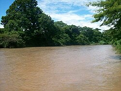
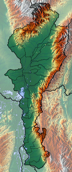
Cesar-Ranchería Basin
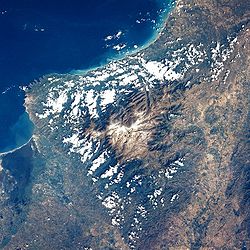
The mountain ranges Sierra Nevada de Santa Marta and the Serranía del Perijá enclose the narrow triangular intermontane basin, that covers an area of 11,668 square kilometres (4,505 sq mi).
The coals are mined from the Paleocene Cerrejón Formation, that also has provided several important paleontological finds, among others Titanoboa cerrejonensis, with an estimated length of 14 metres (46 ft) and a weight of 1,135 kilograms (2,502 lb), the biggest snake discovered to date, the giant crocodylians Cerrejonisuchus improcerus, Anthracosuchus balrogus and Acherontisuchus guajiraensis, and the large turtles Carbonemys cofrinii, Puentemys mushaisaensis and Cerrejonemys wayuunaiki.
Various genera of flora, as Aerofructus dillhoffi, Menispermites cerrejonensis, M. guajiraensis, Montrichardia aquatica, Petrocardium cerrejonense and P. wayuuorum, Stephania palaeosudamericana and Ulmoidicarpum tupperi among others, have been found in the Cerrejón Formation, the sediments of which are interpreted as representing the first Neotropic forest in the world.
The basin is estimated to host the second-largest reserves of coal bed methane (CBM) of Colombia, with 25% of the country's total resources.
Compressional tectonic movement commenced in the Late Paleogene, creating an intermontane foreland basin enclosed by the Serranía del Perijá and the Sierra Nevada de Santa Marta.
The east-west oriented dextral strike-slip Oca Fault in the north is estimated to have been active since the Early Eocene with a total displacement of 180 kilometres (110 mi).
Intense magmatism and metamorphism affected the Sierra Nevada de Santa Marta and the Central Ranges of the Colombian Andes.
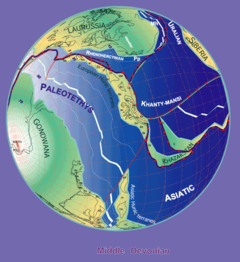
[39] The break-up of Pangea in the Early Jurassic generated a sequence of rift basins in northern South America, surrounding the proto-Caribbean.
[39] The rift basin setting spanned the Jurassic period and was followed by post-rift sedimentation in the Early Cretaceous, evidenced by the Río Negro and Lagunitas Formations.
[40] The initiation of this compressive phase has been dated to the Maastrichtian, when tectonic uplift and deformation was active in the Central Ranges, to the west of the basin.
The fossil flora and gigantic reptiles of the Cerrejón Formation provided abundant data on the paleo-ecology and climate of this first Neotropic environment of the Middle Paleocene.
[57] The basin was intruded by granites during the Early to Middle Jurassic being accompanied by volcanics and volcanoclastic sediments such as the basalts, tuffs, sandstones and breccias found in the Sierra Nevada de Santa Marta.
This magmatic phase correlated with the sedimentary sequence of the La Ge Group, subdivided into the Tinacoa and Macoíta Formations, a series of tuffaceous sandstones, limestones, shales and siltstones.
[56] The sedimentary sequence drilled in the basin starts with the La Quinta Formation, that is found in a widespread area across northern Colombia and Venezuela.
[55] The Early Cretaceous Río Negro Formation, a unit composed of sandstones, conglomerates and siltstones, is very variable in thickness in the basin and associated with continental sedimentation on rift shoulders to a post-rift setting.
[100] The fossiliferous limestones and shales of the Lagunitas Formation, lower member of the Cogollo Group, contain beds of dolomite and are indicative of a shallow, saline environment.
The variation in lithologies and organic content of this source rock formation is associated with basinal relative sea level changes and the organic-rich strata to the Aptian anoxic event, dated to approximately 120 million years ago.
[52][101] The Lower Cretaceous series is followed by the deposition of the regional main source rock of northern Colombia and northwestern Venezuela, La Luna.
The world class source rock contains high levels of Total Organic Carbon, comparable to the Kimmeridge Clay Formation of the basins of the North Sea.
[52] The ammonite-rich shales and biomicrites of La Luna were deposited during the global anoxic event of the Cenomanian-Turonian (around 90 Ma) characterised by a maximum flooding surface sequence.
[104] The global climate was very hot in this period and in the restricted basin between the two forming mountain ranges, a unique ecosystem developed; the first Neotropic forest.
[105] Provenance analysis of the sediments of the Los Cuervos and Cerrejón Formations show a predominant west to east paleocurrent, followed by a more southeastern flow.
[108] In contrast, the Neogene conglomerates of the Cuesta Formation show a larger thickness in the southwestern part of the basin, close to the connected Middle Magdalena Valley.
[109] During this period, especially in the Late Miocene to Pliocene, the Oca and Bucaramanga-Santa Marta Faults were tectonically active,[110] which is still observed in the present day.
Total probable gas reserves for CBM are estimated at between 12.8 and 25.1 trillion cubic feet (360×10^9 and 710×10^9 m3),[13] Vitrinite reflectance data from several source rocks of the Cesar-Ranchería Basin show present-day mature to overmature Cretaceous formations (La Luna, Aguas Blancas and Lagunitas Formations) and (marginally) mature Paleocene source rocks, mainly Los Cuervos.
[4] Apatite fission track analysis and modeling combined with vitrinite reflectance data, showed the Cretaceous units have a significant potential for hydrocarbon generation.