Chapai Nawabganj District
It is said that this area had strategic and commercial importance due to its location at the junction of the rivers Mahananda and the Ganges.
The gateway of North Bengal, Malda was once the capital of Gour-Banga, with 3456 km2 of land classified as Tal, Diara, and Barind.
Malda awaits the advent of tourists and people of archaeological interest with its wealth to be enjoyed and its huge potential to be explored.
It has witnessed different empires which were raised, flourished, and then cast down near oblivion by a successor kingdom built up on the relics of its predecessor.
Gour and Pundrabardhana formed parts of the Mourya empire as is evinced from the inscriptions, Brahmilipi on a seal discovered from the ruins of Mahasthangarh in the Bogra District of Bangladesh.
The inscriptions discovered in the district of undivided Dinajpur and other parts of North Bengal along with the Allahabad Pillar inscriptions of Samudragupta clearly indicate that the whole of North Bengal as far east as Kamrup formed a part of the Gupta Empire.
It was during their reign that the Jagadalla Vihara (monastery) in Barindri flourished paralleling with Nalanda, Vikramshila, and Devikot.
During the early part of the Sultanate, Gauda was the capital and numerous mosques and other buildings were built there.
Sirajuddaulah was defeated by Lord Clive at the battle of Plassey in 1757, which marked the beginning of British rule.
In 1813, in consequence of the prevalence of serious crimes in the Kaliachak and Sahebganj thanas and also on the rivers, a joint magistrate and deputy collector were appointed at English Bazar with jurisdiction over a number of police stations centred around that place and taken from the two district.
Between 12 and 15 August 1947 whether the district would become part of India or Pakistan was unknown, as the announcement of the Radcliffe Line did not make this point clear.
Rajshahi and Naogaon is on the east, while on the Indian side is Malda of West Bengal, the rest of India is on the north.
Four to five small union parisad like narayonpur, johurpur, sundorpur, baghdanga has shifted to the other side of the river Padma.
Chapai Nawabganj sadar, part of Gomostapur Upozilla and Nachol constitutes the borendra area.
The soil of this area are very fertile and people can cultivate multiple times a year of different type of crops.
But still in rainy season, this river becomes very dangerous as the water level grows high and floods the area nearby.
The Pagla River also flows from India and enters into Bangladesh in this district[7] at Tattipur, Moraganga (dead gangis).
The climate of Rajshahi is generally marked with monsoons, high temperature, considerable humidity and moderate rainfall.
The hot season commences early in March and continues till the middle of July.
Chapai Nawabganj District has a literacy rate (age 7 and over) of 72.00%, compared to the national average of 74.80%, and a sex ratio of 93.56 males per 100 females.
But as there are a number of rivers flowing through this district, and many people depend on fishing and other related activities.
Chapainawabganj is called the capital of the mango in Bangladesh because it is this summer fruit that is the main product that sustains the economy of this district.
[12] Now-a-days, Gambhira reflects contemporary social problems through witty dialogue, songs, dances and jokes.
This is the main part in any cultural celebration in this district with great entertainment and explanation of social problems.
And the construction of the Jamuna Bridge at Sirajganj also makes its transportation system an important one all over the country.
The BRTC bus service serves for the long intra-district route to almost all important districts of Bangladesh.
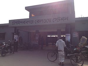
Banalata Express is one of the non-stop rail service of the country which starts from Chapainawabganj and end at capital city Dhaka.
One of the international rail line passes through this district to Malda, West Bengal, India.