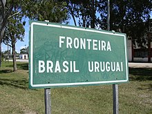
Chuy
Chuy (Spanish pronunciation: [ˈtʃwi]) is a city in the extreme east of Uruguay, in the Rocha Department, 340 kilometres (211 mi) northeast of Montevideo.
[3] The Brazilian historian Péricles Azambuja alludes to a rumor that the word (originally Chyu) would have been brought by former tribes who migrated from the Andes.
[4] By order of the Governor of Montevideo, José Joaquín de Viana, in 1751, frontier military posts were created, with colonial guards on both sides of the Chuy stream, the result of the discussions that had prevailed in the courts of the Spanish and Portuguese crowns.
At that time, Pedro de Cevallos ousted the Portuguese colony of Santa Teresa and San Miguel, and Chuy came to dominate the southern Rio Grande do Sul.
The situation was unstable, however, and the signing of the Treaty of San Ildefonso on October 1, 1777, led to a clearer demarcation of dominions in South America.
[5] In 1762 after the surrender of Colonia del Sacramento, Pedro de Cevallos went to the Portuguese, demanding the "eviction of the Yacuí River and areas of Rio Pardo, Santo Amaro, Rio Grande, San Gonzalo, San Miguel and Chuy, as well as Martín García Island and Dos Hermanas Island."
The 1861 map of the area by Emilio Laviña includes a ranch, stalls and a store belonging to the firm Peyre Seijo & Co.
In addition to this general trade store, there existed a chemist and a teacher named Marcelino Villazuso, who gave private lessons for many years.
The growing importance of this border and the existence of military posts on the Brazilian side, prompted the authorities to install a police station or Comandancia de Frontera depending on Maldonado in 1872.
[citation needed] The BR 471 road in Brazil running from Porto Alegre and Pelotas borders the Chui town and passes through to Uruguay where it becomes Ruta 9.
The council organizes cultural activities jointly with the neighbouring Brazilian town of the same name as the "Carnival Chuy-Chuí Without Borders".
It is not unusual for Uruguayans from the Montevideo area to make long journeys in order to purchase goods across the border which would cost significantly more at home.
[15] The Fuerte San Miguel, 8 kilometres to the west, was built on top of a hill in 1737 (construction was started in 1734) with a square plan by the Portuguese.
The fort, built with large and heavy stones to create the tall towers (four bastions), thick walls and sturdy ramparts to withstand onslaught of wars that were fought against the Spanish invaders was instrumental in Uruguay evolving as an independent nation.
As a protected area, the diverse natural ecosystems has also been retained where native wildlife of Monkeys, birds, capybaras and guazubira are seen in the forests and marshland.
[20] Fortaleza de Santa Teresa which was declared a National Historic Monument by Law on December 26, 1927, has rich history of battles.
However, construction was stopped in 1763 when Don Pedro de Cevallos Governor from Buenos Aires' captured the forts of Santa Teresa and also San Miguel.
[21] In 1797, to maintain law and order in the region, the Veteran Force of Blandengues of the Montevideo Border established in 1796, made it their headquarters.