Climate of Oregon
[2] In the Willamette Valley east of the Coast Range, storms "blowing" from the Pacific retain enough moisture to drop from 35 to 45 inches (890 to 1,140 mm) annually in the most heavily populated part of the state.
East of the valley, the storm air rises again as it meets the Cascade Range, cooling once more and forming condensate at elevations often as low as 3,000 feet (910 m).
[2] Since volcanic peaks in the range are quite high—more than 11,000 feet (3,400 m) in the case of Mount Hood[4]—most of the remaining Pacific moisture falls here in the form of rain or snow.
Statewide, the dry months are July and August, when moisture arrives during afternoon thunderstorms, mainly in the mountains, and less often from storms that reach the north coast and adjacent counties.
Based on data from ski resorts and a few official weather stations, average annual snowfall in the Cascades can range from 300 to 550 inches (760 to 1,400 cm).
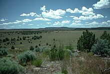
East of the Cascades, in non-mountain settings, the annual totals range from 15 to 75 inches (38 to 191 cm), depending on location; they are smallest in the north-central region and the Snake River basin in the southeast and largest in the northeastern valleys and in the high plateaus of the south-central part of the state.
[3] In addition to seasonal cycles in solar radiation (more in summer, less in winter), major factors affecting temperatures in Oregon include the moderating influence of the Pacific Ocean combined with variations in surface elevation, especially the Cascade Range.
This prevailing pattern breaks down occasionally when dense cold air flows down the Columbia Gorge into the Willamette Valley and lowers temperatures more than usual from Portland to Eugene.