Coastline of Tamil Nadu
[1] Chennai, the capital of the state and an important commercial and industrial center in the country is located in the northern part of the coast with Kanniyakumari, forming the southern tip where Indian Ocean, Bay of Bengal and Arabian Sea meet.
The coastal corridor consists of 14 districts with 15 major ports and harbors, sandy beaches, lakes and river estuaries.
[2] Pamban Island forms part of Ramanathapuram district separating Gulf of Mannar and Palk strait with the Ram Setu connecting it with Sri Lanka.
[3] There are 14 districts that share the coastline namely Thiruvallur, Chennai, Chengalpattu, Villupuram, Cuddalore, Mayildathurai, Nagapattinam, Tiruvarur, Thanjavur, Pudukottai, Ramanathapuram, Thoothukudi, Tirunelveli and Kanyakumari.
The coast of Tamil Nadu was a part of ancient silk route and played an important role in spice trade with western empires.
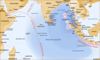
[9] In 1025, Rajendra Chola, the Chola king from Coromandel in South India, launched naval raids on ports of Srivijaya in Southeast Asia and against the Burmese kingdom of Pegu,[10][11] and conquered parts of Srivijaya in Malaysia and Indonesia and the Tambralinga Kingdom in Southern Thailand and occupied it for some time.
Larger oceangoing vessels coming from the West have had to navigate around Sri Lanka to reach India' eastern coast.
According to official estimates, more than 10,000 people were killed and hundreds of thousands made homeless when a tsunami triggered by the 2004 Indian Ocean earthquake near the Indonesian island of Sumatra struck the southern coast of Tamil Nadu on 26 December 2004.