Columbia Bar
The Columbia current varies from 4 to 7 knots (7.4 to 13.0 km/h) westward, and therefore into the predominantly westerly winds and ocean swells, creating significant surface conditions.
[7] The nearby United States Coast Guard Station Cape Disappointment, Washington, is renowned for operating in some of the roughest sea conditions in the world, and is home to the National Motor Lifeboat School.
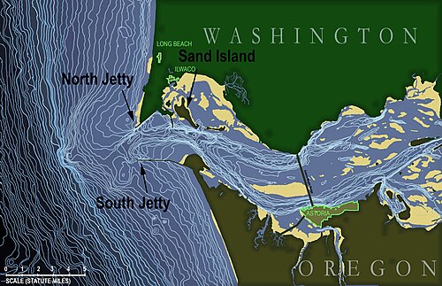
[9] They generally consider "the bar" to be the area between the north and south jetties and Sand Island (see detail of bathymetric map for locations of these).
The "Graveyard" also includes the rocky, rugged shoreline of the west coast of Vancouver Island, the shores of the Olympic Peninsula, and the Strait of Juan de Fuca.
[11][12] The most accessible place to watch ships cross the bar is at the South Jetty viewing platform at Fort Stevens State Park located near Warrenton, Oregon.