Corona, California
Corona (Spanish for "Crown") is a city in northwestern Riverside County, California, United States.
Corona is surrounded by Riverside to the east, Norco to the north and northeast, Yorba Linda to the northwest, Cleveland National Forest and the Santa Ana Mountains to the west, southwest, and south.
Corona, located along the western edge of Southern California's Inland Empire region, is known as the "Circle City" due to Grand Boulevard's 3 mi (4.8 km) circular layout.
What is now Corona stood at the southeastern extent of Tovaangar, or the Tongva world, and at the northern edge of Payómkawichum territory.
[9][10] The primary settlement in the area was the village of Paxauxa, which was established along the banks of the Temescal Creek at about where Corona is situated today.
[11][12] High above the city of Corona, the village of Pamajam was also located in a small valley of the Santa Ana Mountains.
[15] Spanish influence increased in the area with the establishment of the San Antonio de Pala Asistencia in 1816.
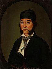
Two years following the construction of this mission outpost, the Temescal Valley's first European resident, Leandro Serrano, was given permission by the Spanish to use the area for cattle grazing.
In 1848, Californio governor Pio Pico issued this land to Bernardo Yorba, which included present-day city of Corona.
The nickname of Corona is "The Circle City" from the unique layout of its streets, with a standard grid enclosed by the circular Grand Boulevard, 2.75 miles (4.43 km) in circumference.
[18] The street layout was designed by Hiram Clay Kellogg, a civil engineer from Anaheim who was an influential figure in the early development of Orange County.
This company purchased all the water-bearing lands in the Temescal valley and began drilling artesian wells.
In 1896, the city was renamed "Corona" for its circular Grand Boulevard, where three international automobile races were held in 1913, 1914 and 1916.
[23] The city of Corona has been popular among celebrities drawn to its upscale areas and relative privacy compared to Los Angeles.
[27] Main Street Realtors wrote, "Prior to the 1980s, the city was largely an agricultural community, dominated by citrus orchards, ranches, and dairy farms.
The effort was also considered by areas in other cities in the western part of the county as far south as Murrieta.
But compared to other areas in Southern California, winter lows are colder, with common frost and chilly mornings.
[30][31] In early summer, Corona receives common overcast weather known as "May Gray" and "June Gloom".
Autumn features warm days and sharply cooler evenings, but can be windy due to the Santa Ana winds, blowing in two or three times a year from October to December.
Businesses and organizations with global, national or major regional headquarters in Corona include: According to the city's 2024 Comprehensive Annual Financial Report,[39] the top employers in the city are: The 2010 United States Census[44] reported that Corona had a population of 152,374.
Hispanic or Latino of any race were 66,447 persons (41.9%); 33.7% of Corona's population are Mexican-American, 2.1% Puerto Rican, 1.2% Cuban, 1.2% Salvadoran, 1.1% Guatemalan, 0.5% Colombian, 0.5% Peruvian, 0.5% Argentine, 0.3% Honduran, 0.2% Nicaraguan, and 0.2% Ecuadorian.
Among Asian-Americans, 2.3% of Corona's population were Filipino, 2.1% Vietnamese, 1.7% Korean, 1.4% Indian-Americans, 1.1% Chinese, 0.7% Japanese, 0.4% Pakistani, 0.2% Thai, and 0.1% Bangladeshi.
Federal: State: Local: The city's downtown area is circled by Grand Boulevard, which is unique for being perfectly circular.
There is a proposal to erect a new four-lane freeway along or near Cajalco Road to connect Interstates 15 and 215, although the plan remains controversial.
In addition, there is a possibility of constructing a 7.5 mi (12.1 km) tunnel under the Santiago Peak Mountains to the Eastern Transportation Corridor of the FastTrak toll-road company system in Orange, due to increased commuter traffic on State Route 91, which needs to be reduced by another freeway between Orange and Riverside counties.
On January 20, 2008, two small passenger aircraft collided over Corona, killing all four men aboard the planes and another man on the ground.
The city is linked with the 91/Perris Valley Line and Inland Empire–Orange County Line of the Metrolink commuter rail system, providing service to Los Angeles, Perris, San Bernardino, and Oceanside from Corona–North Main station in the Downtown area and Corona–West station in Corona's west side.
law enforcement is provided by the city of corona police department, along with the Riverside county sheriff's office.
There are also 28 elementary schools in the city: John Adams, Susan B. Anthony, Cesar Chavez, Corona Ranch, Coronita, Dwight Eisenhower, Foothill, Ben Franklin, Garretson, Home Gardens, Jefferson, Lincoln Alternative, William McKinley, Orange, Parkridge, Prado View, Promenade, Riverview, Ronald Reagan, Sierra Vista, Stallings, Temescal Valley, Dr. Bernice Todd, Vandermolen, Vicentia, Victress Bower, George Washington and Woodrow Wilson.