Course (orienteering)
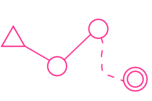
Controls are marked with a white and orange flag in the terrain, and corresponding purple symbols on an orienteering map.
The challenge is to complete the course by visiting all control points in the shortest possible time, aided only by the map and a compass.
Linear features such as fences, walls, and paths generally offer low difficulty; natural features such as forest or open moor can offer high difficulty.
Physical difficulty is determined by the length of the course, the amount of climb, and the kinds of terrain (rocky, boggy, undergrowth etc.).
Great care is taken to ensure that developing juniors are provided with a course that gives them a satisfying challenge without pushing them beyond their current ability.
[1] When designing a course, the aim is to present a course that is suited to the ability of the competitor, and such that orienteering skills (fast map reading, running in rough terrain, finding the best route, etc.)
In both systems, White courses have the least technical challenge, followed by Yellow and Orange.
In both systems, all other courses (Red, Blue, Green, Brown, Black) are for advanced competitors and vary only in their degree and kind of physical challenge.
[3][4][5] In OUSA, the guidelines for designing course levels are as follows: White—2-3 kilometers, winning time: 25-30 min., age up to 12 Control points should be close together, large and very easy (f.ex.
The path should be along linear features, like trails, roads and stone walls.
However, for brown, green, red and blue courses, the control requirements are basically the same.
Place controls before linear features instead of after them so that more skilled navigators have an advantage.