Czech Hiking Markers System

Basic implementation of the system requires only a color paint and a brush (plus a cardboard cut matrix for even size of the signs), with which an entire country can be marked.

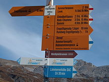
This method of trail blazing has a wide international usage in most of Central and Eastern Europe (including the Balkans and Caucasus), with showcase examples also in parts of Latin America and Asia.

[1] The entire territory of the Czech Republic is covered with marked trails,[2] and detailed maps are published and widely available.

The volunteers marking these trails usually prepare sheet metal or cardboard matrices to keep the signs uniform in size.

There are also symbols for short side-trails (to peak or lookout, ruin, well or spring, or other point of interest) and for the end of the trail.

Arrow signs at the start of two trails - blue and green
Coloured markers throughout the trail accompany the hiker - this is the blue marked trail
Tourist Map Application showing different trails in colors (red, blue, yellow and green) and related information for the hiker
Left Turn Marker on a blue trail - marker showing the change of direction of the trail
Printed map with green and blue trail marked. The color coded trails in many mobile applications are used by tourists and hikers. They also enable route planning, information about its difficulty etc.
Basic Marker - Red colour used for difficult or summit trails
Cardboard Matrix for a basic marker of 10x10 cm - used by volunteers painting the markers along the trail
Several trails marked together before they split in different directions
Switzerland - colours denoting difficulty