DH postcode area
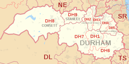
The DH postcode area, also known as the Durham postcode area,[2] is a group of nine postcode districts in north-east England, within five post towns.
These cover northern County Durham (including Durham, Chester-le-Street, Consett and Stanley), parts of southern Tyne and Wear (including Houghton-le-Spring) and a small part of southern Northumberland.
The approximate coverage of the postcode districts: