DL postcode area
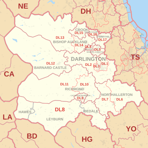
The DL postcode area, also known as the Darlington postcode area,[2] is a group of seventeen postcode districts in England, which are subdivisions of fourteen post towns.
These districts cover central County Durham (including Darlington, Bishop Auckland, Ferryhill, Crook, Spennymoor, Shildon, Barnard Castle and Newton Aycliffe), northern North Yorkshire (including Northallerton, Bedale, Hawes, Leyburn, Richmond and Catterick Garrison) and a very small part of Cumbria.
The approximate coverage of the postcode districts: