Distributed GIS
Distribution of resources provides corporate and enterprise-based models for GIS (involving multiple databases, different computers undertaking spatial analysis and a diverse ecosystem of often spatially-enabled client devices).
In 1994, he designed and implemented the World Wide Earthquake Locator, which provided maps of recent earthquake occurrences to a location-independent user, which used the Xerox PARC Map Viewer (based in California, USA), managed by an interface based in Edinburgh (Scotland), which drew data in real-time from the National Earthquake Information Center (USGS) in Colorado, USA.
For example, remote sensing and surveying equipment have been providing vast amounts of spatial information, and how to manage, process or dispose of this data have become major issues in the field of Geographic Information Science (GIS).
Due to extensive interaction and work-flow between departments, many organisations have in recent years switched from independent, stand-alone GIS systems to more integrated approaches that share resources and applications.
The corporate database is specifically designed to efficiently and effectively suit the requirements of the organisation.
Benefits include that all the users in the organisation have access to shared, complete, accurate, high quality and up-to-date data.
A successfully managed corporate database reduces redundant collection and storage of information across the organisation.
[18] Internet GIS helps to solve that problem by allowing users to access vast databases impossible to store on a single desktop computer, and by allowing rapid dissemination of both maps and raw data to others.
This has enabled the general public to participate in map creation and make use of GIS technology.
[33][34] With ~80% of all data deemed to have a spatial component, modern Mobile GIS is a powerful tool.
[36] The number of mobile devices in circulation has surpassed the world's population (2013) with a rapid acceleration in iOS, Android and Windows 8 tablet up-take.
[1] CyberGIS, or cyber geographic information science and systems, is a term used to describe the use of cyberinfrastructure, to perform GIS tasks with storage and processing resources of multiple institutions through, usually through the World Wide Web.
CyberGIS has been described as "GIS detached from the desktop and deployed on the web, with the associated issues of hardware, software, data storage, digital networks, people, training and education.
ROGER, hosted by the National Center for Supercomputing Applications, is optimized to deal with geospatial data and computation and is equipped with: CyberGIS software and tools integrate these system components to support a large number of users who are investigating scientific problems in areas spanning biosciences, engineering, geosciences, and social sciences.
The first generation was from 1993 onwards and consisted of simple image maps which had a single click function.
It developed out of an increasing awareness that many search engine users are using it to look for a business or service in the local area.
[44] The main standards for Distributed GIS are provided by the Open Geospatial Consortium (OGC).
OGC is a non-profit international group that seeks to Web-Enable GIS and, in turn Geo-Enable the web.
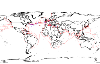
One of the major issues concerning distributed GIS is the interoperability of the data since it can come in different formats using different projection systems.
GSM consists of two components: the mobile radio telephone and Subscriber Identity Module.
For GSM enhancement General Packet Radio Service (GPRS), a packet-oriented data service for data transmission, and Universal Mobile Telecommunications System (UTMS), the Third Generation (3G) mobile communication system, technology was introduced.
Wireless Application Protocol (WAP) is a standard for the data transmission of internet content and services.
It is a secure specification that allows users to access information instantly via mobile phones, pagers, two-way radios, smartphones, and communicators.
WAP supports HTML and XML, and WML language, and is specifically designed for small screens and one-hand navigation without a keyboard.
WML is scalable from two-line text displays up to the graphical screens found on smartphones.