Domfelsen
This outcrop of bedrock may be viewed as a continuation of the Flechtingen Hills that, in the urban area of Magdeburg, is mostly covered by a thin layer of Quaternary depositions.
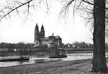
The rocks, which are clearly visible on the west bank below the cathedral when water levels are low, affect local current conditions.
Historically the rocks were important because it was likely that a ford had been created here by the Elbe which could eventually have resulted in the settlement that led to the city of Magdeburg growing up on its present site.
Because the rocks in the river are only exposed at low water levels, which are associated with drought and poor harvest, they were also nicknamed the Hungerfelsen by the local population.
Apart from fears of the impact on water levels in the floodplains, especially upriver, opponents criticize the removal of the rock which is seen as the first step of the ecologically controversial and unapproved expansion of the River Saale.