Neighborhoods of Davenport, Iowa
The neighborhoods contain many architectural designs, including Victorian, Queen Anne, and Tudor Revival.
Development in the west end of Downtown shifted from commercial to residential buildings, mostly in the form of apartments.
The focus of the neighborhood was Washington Square—a single block laid out by Antoine LeClaire in the original city.
The neighborhood was a prime location for prominent Germans and contains mostly residential structures; there are very few commercial buildings or churches.
Other housing designs in the neighborhood include Victorian, Gothic Revival, Italianate, Second Empire, and Queen Anne.
It contains densely built large- and medium-sized houses set close together as well as the Sacred Heart Cathedral.
Another two blocks are dedicated to large-scale education and religious buildings, including the Palmer College of Chiropractic campus.
The most prominent of the residences was built by Ambrose Fulton, who was significant to Davenport's early settlement and its industrial history.
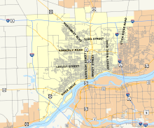
[1] The land is made up of many hills and ravines; the streets follow the topography, requiring many winding roads and odd-shaped lots.
[1] Developed from south to north, four very large mansions built before World War I were coveted by upper-middle class residents.
[1] Unlike similar west end and central neighborhoods, Prospect Park has remained composed primarily of single-family homes.
[1] It experienced three stages of growth: the period following the American Civil War, when many residential buildings were built; from 1890 to 1915, when construction of large mansions on the bluffs (allowing views of the Mississippi River) began; and the turn of the twentieth century, at the far east end of the neighborhood and the city.
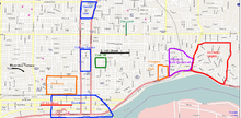
It is bounded to the west by Judson Street, to the north by Kirkwood Boulevard, to the east by Jersey Ridge Road, and to the south by River Drive.
Lindsay Park is located in the southeast corner and was used as parade grounds for soldiers from Camp McClellan during the Civil War.
Columbia Avenue is a neighborhood located north and west of Vander Veer Botanical Park.
The neighborhood contains 27 middle-class houses developed from 1900 to 1910 by Amos Cutter, a local real estate entrepreneur.
The houses were mostly one and a half- to two-story front gable American Foursquare and simplified Queen Anne buildings.
[1] The West End part of the area is filled with people who are mildly poor to the point of Poverty and several are classified to be uneducated.