Downtown Indianapolis
Downtown has grown from the original 1821 town plat—often referred to as the Mile Square—to encompass a broader geographic area of central Indianapolis, containing several smaller historic neighborhoods.
Downtown contains numerous historic districts and properties, most of the city's memorials and monuments, performing arts venues, and museums.
When Indianapolis was founded in 1820, the new capital city was planned to occupy an area of one square mile (2.6 km2) adjacent to the White River and near the geographic center of Marion County.
The plat included eastern and western "anchors": the Indiana Statehouse (west) and the Indianapolis City Market and Marion County Courthouse (east), respectively.
As the population increased and the city matured, the original plat continued to densify, developing into the region's central business district.
(about 7 square miles) Downtown Indianapolis is sited on flat terrain near the confluence of the White River and Fall Creek.
Downtown Indianapolis dates to the city's founding as the state of Indiana's new capital in 1820 near the east bank of the White River.
The state legislature appointed Alexander Ralston and Elias Pym Fordham to survey and design a town plan for Indianapolis, which was platted in 1821.
Ralston's grid pattern with wide roads and public squares extended outward from the four blocks adjacent to the Circle, and also included four diagonal streets, later renamed as avenues.
Tennessee and Mississippi Streets were renamed Capitol and Senate Avenues in 1895 after several state government buildings were built west of the Circle near the Indiana Statehouse.
[10] In the last half of the nineteenth century, when the city's population soared from 8,091 in 1850 to 169,164 in 1900, urban development expanded in all directions as Indianapolis experienced a building boom and transitioned from an agricultural community to an industrial center.
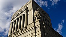
[11] Some of the city's most iconic structures were built during this period, including several that have survived to the present day in Downtown: the Soldiers' and Sailors' Monument (1888, dedicated 1902), the Indiana Statehouse (1888), Union Station (1888), and the Das Deutsche Haus (1898), among others.
[12] Following World War II, expansion of the American middle class, suburbanization, and declining manufacturing employment greatly impacted Downtown Indianapolis, similar to most U.S. central business districts at this time.
Among the first projects was the opening of Market Square Arena, which served as home to the Indiana Pacers and host to numerous concerts and other sporting events.
The success of Market Square Arena helped persuade decision-makers to make Downtown the center of an aggressive sports tourism strategy.
Throughout the 1980s, $122 million in public and private funding built several athletic facilities Downtown, including the Indianapolis Tennis Center, Indiana University Natatorium, Carroll Track and Soccer Stadium, and the Hoosier Dome.
The latter project helped secure the 1984 relocation of the Baltimore Colts, the 1987 Pan American Games, and scores of subsequent athletic events of national and international interest.
The city's successful sports tourism campaign provided local leadership with a template for increasing Downtown's capacity to host conventions and trade shows.
The John Morton-Finney Center for Educational Services at Walnut and Delaware streets houses the administrative headquarters for Indianapolis Public Schools.
The United States Postal Service operates two post offices downtown as well as its Indianapolis Processing and Distribution Center on South Street.
Recent developments in downtown Indianapolis include the construction of new mid- to high-rise buildings and the $275 million expansion of the Indiana Convention Center completed in 2011.
[29][30][31][32] Notable independent establishments, such as St. Elmo Steak House and Slippery Noodle Inn, mix with chains in the blocks surrounding Circle Centre Mall in downtown's Wholesale District.
[37] Neighboring White River State Park contains the Eiteljorg Museum of American Indians and Western Art and the NCAA Hall of Champions.
[40] Note: Entries in italics denote privately-owned parks and plazas or those not under the management of the State of Indiana or the City of Indianapolis.
[47][48] Opened in 1904 on Market Street, the Indianapolis Traction Terminal was the largest interurban station in the world, handling 500 trains daily and 7 million passengers annually.
IndyGo operates the city's public transit network, with downtown Indianapolis serving as the region's hub and spoke origin.