Earth Observing System
Since the early 1970s, NASA has been developing its Earth Observing System, launching a series of Landsat satellites in the decade.
[1] Collected in a system known as EOSDIS, NASA uses this data in order to study the progression and changes in the biosphere of Earth.
Prior to the development of the current Earth Observing System (EOS), the foundations for this program were laid in the early 1960s and 1970s.
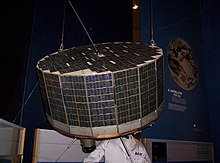
Critical to the development of the satellites currently in use, TIROS-1 was a program that allowed NASA to use experimental instruments and data collection methods to study meteorology worldwide.
[1] After the success of TIROS-1 and ATS-3, NASA in conjunction with United States Geological Survey (USGS), progressed forward in Earth observation through a series of Landsat satellites launched throughout the 1970s and 1980s.
The Nimbus 5 satellite launched in 1972 used passive microwave imaging; a highly successful method to observe changes in sea ice cover.
[1] Observation was furthered by succeeding missions such as Nimbus 7, fitted with a coastal zone colour scanner (CZCS) for detailing colour changes in the Earth's oceans, and a Total Ozone Mapping Spectrometer (TOMS) to measure solar irradiance and the reflected radiance from the Earth's atmosphere.
[1] Since the inception of the program, the aim overall has remained the same: "monitor and understand key components of the climate system and their interactions through long-term global observations.
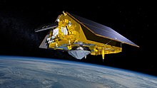
A key objective of the sentinel missions is to monitor sea level rise, a primary indicator of climate change and global warming.
As Paris Agreement policy and more countries aim for a carbon neutral world, the data collected by Sentinel missions will assist in the continued understanding of the Earth's changing climate.
As a part of its payload, it will use Global Navigation Satellite System Radio Occultation (GNSS-RO), a method to detail changes and information of different layers in the atmosphere.
This project will be an intergovernmental collaboration between NASA and National Oceanic and Atmospheric Administration (NOAA) and will observe a new generation of Polar Orbiting environmental satellites.
The payload for this type of satellite will include Visible Infrared imaging Radiometer, Advanced Technology Microwave Sounder and Ozone Mapping and Profiler Suite.