Earthworks (archaeology)
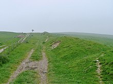
Shallow earthworks are often more visible as cropmarks or in aerial photographs if taken when the sun is low in the sky and shadows are more pronounced.
LIDAR results can be input into a geographic information system (GIS) to produce three-dimensional representations of the earthworks.
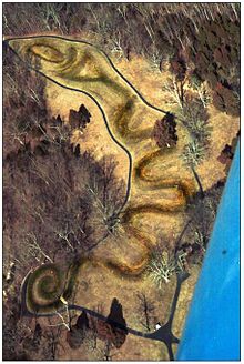
Located in Ohio, this 411-metre-long (1,348 ft) earthen work is thought to memorialize alignments of the planets and stars that were of special significance to the Native Americans that constructed it.
[23] The earthworks at Poverty Point occupy one of the largest-area sites in North America, as they cover some 920 acres (320 ha) of land in Louisiana.
[25] The largest earthwork fort built during the war was Fortress Rosecrans, which originally encompassed 255 acres (103 ha).[26][relevant?]
In northeastern Somalia, near the city of Bosaso at the end of the Baladi valley, lies an earthwork 2 to 3 km (1.2 to 1.9 mi) long.
On the south shore of the Katonga river, the Bigo earthworks consist of a series of ditches and berms comprising an outer arch that encompasses four interconnected enclosures.