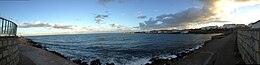
Irish Sea
The Norman invasion of Ireland took place in stages during the late 12th century from Porthclais near St. Davids, Wales, in Hulks, Snekkars, Keels and Cogs[11] to Wexford Harbour, Leinster.
[11] In 1690 the English fleet set sail for the Williamite War in Ireland from Hoylake, Wirral, the departure becoming permanently known as King's Gap as a result.
[citation needed] Because Ireland has neither tunnel nor bridge to connect it with Great Britain, the vast majority of heavy goods trade is done by sea.
The Caernarfon Bay basin contains up to 7 cubic kilometres (1.7 cu mi) of Permian and Triassic syn-rift sediments in an asymmetrical graben that is bounded to the north and south by Lower Paleozoic massifs.
Wells in the Irish Sector to the west have demonstrated that pre-rift, Westphalian coal measures are excellent hydrocarbon source rocks, and are at peak maturity for gas generation (Maddox et al., 1995).
Seismic profiles clearly image these strata continuing beneath a basal Permian unconformity into at least the western part of the Caernarfon Bay Basin.
Maximum burial of, and primary gas migration from, the source rocks could have terminated as early as the Jurassic, whereas many of the tilted fault blocks were reactivated or created during Paleogene inversion of the basin.
However, it is also possible that a secondary gas charge occurred during regional heating associated with intrusion of Paleogene dykes, such as those that crop out nearby on the coastline of north Wales.
(Floodpage et al., 1999) have invoked this second phase of Paleogene hydrocarbon generation as an important factor in the charging of the East Irish Sea Basin's oil and gas fields.
It is not clear as yet whether aeromagnetic anomalies in the southeast of Caernarfon Bay are imaging a continuation of the dyke swarm into this area too, or whether they are instead associated with deeply buried Permian syn-rift volcanics.
Alternatively, the fault block traps could have been recharged by exsolution of methane from formation brines as a direct result of the Tertiary uplift (cf.
The basin has a proven petroleum system, with potentially producible gas reserves at the Dragon discovery near the UK/ROI median line, and oil shows in a further three wells.
Despite the Tertiary structuration, the Dragon discovery has proved that potentially commercial volumes of hydrocarbons were retained at least locally in Cardigan Bay.
In addition to undrilled structural traps, the basin contains the untested potential for stratigraphic entrapment of hydrocarbons near synsedimentary faults, especially in the Middle Jurassic section.
Future mineral exploration will initially concentrate on extending this play, but there remains largely untested potential also for gas and oil within widespread Carboniferous fluvial sandstone reservoirs.
Previous exploration drilling in the Kish Bank Basin has confirmed the potential for petroleum generation with oil shows seen in a number of wells together with natural hydrocarbon seeps recorded from airborne surveys.
analysis of vintage 2-D seismic data has revealed the presence of a large undrilled structural closure at Lower Triassic level situated about 10 kilometres (6 mi) offshore Dublin.
However, given its location in shallow water and close proximity to shore, the prospect is of great interest as exploration drilling, together with any future development costs, are likely to be low.
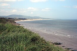
However, a lot of wildlife also depends on the cliffs, salt marshes and sand dunes of the adjoining shores, the seabed and the open sea itself.
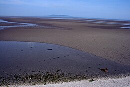
However, the groupings of animals present depend to a large extent on whether the seabed is composed of rock, boulders, gravel, sand, mud or even peat.
In the soft sediments seven types of community have been provisionally identified, variously dominated by brittle-stars, sea urchins, worms, mussels, tellins, furrow-shells, and tower-shells.
However, increasing seasonal storminess leads to greater mixing of water and tends to break down these divisions, which are more apparent when the weather is calm for long periods.
A colossal diversity of invertebrate species live in the Irish Sea and its surrounding coastline, ranging from flower-like fan-worms to predatory swimming crabs to large chameleon-like cuttlefish.
Huge populations of the sea duck, common scoter, spend winters feeding in shallow waters off eastern Ireland, Lancashire and North Wales.
[27] In 2005, a plan to reintroduce grey whales by airlifting 50 of them from the Pacific Ocean to the Irish Sea was claimed to be logically and ethically feasible;[31] it has not been implemented as of 2013.
Grey seals haul out, but do not breed, off Hilbre and Walney islands, Merseyside, the Wirral, St Annes, Barrow-in-Furness Borough, and Cumbria.
Whilst concentrations have declined in line with the reduction in discharges they are markedly higher in the eastern Irish Sea compared to the western areas.
The dispersal of these elements is closely associated with sediment activity, with muddy deposits on the seabed acting as sinks, soaking up an estimated 200 kg (440 lb) of plutonium.
[39] The highest concentration is found in the eastern Irish Sea in sediment banks lying parallel to the Cumbrian coast.
In the UK, the heaviest seafood consumers in Cumbria received a radioactive dosage attributable to Sellafield discharges of 220 μSv (0.022 rem) in 2005.