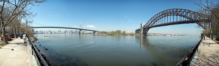
East River
The upper portion (from Long Island Sound to Hell Gate), running largely perpendicular to the glacial motion, is wide, meandering, and has deep narrow bays on both banks, scoured out by the glacier's movement.
Tides from the Long Island Sound, New York Harbor and the Harlem River meet there, making it difficult to navigate, especially because of the number of rocky islets which once dotted it, with names such as "Frying Pan", "Pot, Bread and Cheese", "Hen and Chicken", "Heel Top"; "Flood"; and "Gridiron", roughly 12 islets and reefs in all,[7] all of which led to a number of shipwrecks, including HMS Hussar, a British frigate that sank in 1780 while supposedly carrying gold and silver intended to pay British troops.
Those of the Lenapes who lived in the northern part of Manhattan Island in a campsite known as Konaande Kongh used a landing at around the current location of East 119th street to paddle into the river in canoes fashioned from tree trunks in order to fish.
[16] Historically, the lower portion of the strait, which separates Manhattan from Brooklyn, was one of the busiest and most important channels in the world, particularly during the first three centuries of New York City's history.
Because the water along the lower Manhattan shoreline was too shallow for large boats to tie up and unload their goods, from 1686 on – after the signing of the Dongan Charter, which allowed intertidal land to be owned and sold – the shoreline was "wharfed out" to the high-water mark by constructing retaining walls that were filled in with every conceivable kind of landfill: excrement, dead animals, ships deliberately sunk in place, ship ballast, and muck dredged from the bottom of the river.
Thus, though the battle was a victory for the British, the failure of Sir William Howe to destroy the Continental Army when he had the opportunity allowed the Americans to continue fighting.
The bodies were thrown overboard or were buried in shallow graves on the riverbanks, but their bones – some of which were collected when they washed ashore – were later relocated and are now inside the Prison Ship Martyrs' Monument in nearby Fort Greene Park.
The existence of the ships and the conditions the men were held in was widely known at the time through letters, diaries and memoirs, and was a factor not only in the attitude of Americans toward the British, but in the negotiations to formally end the war.
New York State legislation, which in 1807 had authorized what would become the Commissioners Plan of 1811, authorized the creation of new land out to 400 feet from the low water mark into the river, and with the advent of gridded streets along the new waterline – Joseph Mangin had laid out such a grid in 1803 in his A Plan and Regulation of the City of New York, which was rejected by the city, but established the concept – the coastline become regularized at the same time that the strait became even narrower.
[22] One result of the narrowing of the East River along the shoreline of Manhattan and, later, Brooklyn – which continued until the mid-19th century when the state put a stop to it – was an increase in the speed of its current.
Buttermilk Channel, the strait that divides Governors Island from Red Hook in Brooklyn, and which is located directly south of the "mouth" of the East River, was in the early 17th century a fordable waterway across which cattle could be driven.
[23] The continued narrowing of the channel on both side may have been the reasoning behind the suggestion of one New York State Senator, who wanted to fill in the East River and annex Brooklyn, with the cost of doing so being covered by selling the newly made land.
The New East River through Queens would be about three times the average width of the existing one at an even 3,600 feet (1,100 m) throughout, and would run as straight as an arrow for five miles (8.0 km).
[30] In 1849, a French engineer whose specialty was underwater blasting, Benjamin Maillefert, had cleared some of the rocks which, along with the mix of tides, made the Hell Gate stretch of the river so dangerous to navigate.
Ebenezer Meriam had organized a subscription to pay Maillefert $6,000 to, for instance, reduce "Pot Rock" to provide 24 feet (7.3 m) of depth at low-mean water.
[33] In the late 1860s, after the Civil War, Congress realized the military importance of having easily navigable waterways, and charged the Army Corps of Engineers with clearing Hell Gate.
(The Hurricane of September 3, 1821, created the biggest storm surge on record in New York City: a rise of 13 feet (4.0 m) in one hour at the Battery, flooding all of lower Manhattan up to Canal Street.)
Still, the new seawall begun in 1871 gave the island a firmer edge, improved the quality of the port, and continues to protect Manhattan from normal storm surges.
[48] The East River was the site of one of the greatest disasters in the history of New York City when, in June 1904, the PS General Slocum sank near North Brother Island due to a fire.
There were only 321 survivors of the disaster, one of the worst losses of life in the city's long history, and a devastating blow to the Little Germany neighborhood on the Lower East Side.
The road is sometimes at grade, sometimes runs under locations such as the site of the Headquarters of the United Nations and Carl Schurz Park and Gracie Mansion – the mayor's official residence, and is at time double-decked, because Hell Gate provides no room for more landfill.
[51][52][53] In 1963, Con Edison built the Ravenswood Generating Station on the Long Island City shore of the river, on land some of which was once stone quarries which provided granite and marble slabs for Manhattan's buildings.
At the end of 2022, gold miner John Reeves claimed that up to 50 tons of ice age artifacts bound for the American Museum of Natural History, including mammoth remains, had been dumped into the East River near 65th Street.
[68] Because of these changes to the ecosystem, by 1909, the level of dissolved-oxygen in the lower part of the river had declined to less than 65%, where 55% of saturation is the point at which the amount of fish and the number of their species begins to be affected.
[71] As of 2010[update], the New York City Department of Environmental Protection (DEP) categorizes the East River as Use Classification I, meaning it is safe for secondary contact activities such as boating and fishing.
[72] According to the marine sciences section of the DEP, the channel is swift, with water moving as fast as four knots, just as it does in the Hudson River on the other side of Manhattan.
[71] As of 2013[update], it was reported that the level of bacteria in the river was below federal guidelines for swimming on most days, although the readings may vary significantly, so that the outflow from Newtown Creek or the Gowanus Canal can be tens or hundreds of times higher than recommended, according to Riverkeeper, a non-profit environmentalist advocacy group.
[73] Thanks to reductions in pollution, cleanups, the restriction of development, and other environmental controls, the East River along Manhattan is one of the areas of New York's waterways – including the Hudson-Raritan Estuary and both shores of Long Island – which have shown signs of the return of biodiversity.
[76][77][78][79][80] The loss of the sub-station caused a voltage dip in the power provided by Con Ed to the Metropolitan Transportation Authority's New York City Subway system, which disrupted its signals.
[82][78][83][79] Putting the spill into perspective, John Lipscomb, the vice president of advocacy for Riverkeepers said that the chronic release after heavy rains of overflow from city's wastewater treatment system was "a bigger problem for the harbor than this accident.