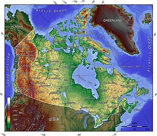
Extreme points of Canada
The northernmost point of land within the boundaries of Canada is Cape Columbia, Ellesmere Island, Nunavut 83°06′40″N 69°58′19″W / 83.111°N 69.972°W / 83.111; -69.972 (Cape Columbia, Nunavut).
[1] The southernmost point is Middle Island, in Lake Erie, Ontario (41°41′N 82°40′W); the southernmost water point lies just south of the island, on the Ontario–Ohio border (41°40′35″N).
[1] The lowest point is sea level at 0 m,[3] whilst the highest point is Mount Logan, Yukon, at 5,959 m / 19,550 ft 60°34′01″N 140°24′18″W / 60.567°N 140.405°W / 60.567; -140.405 (Mount Logan, Yukon).
[1] The westernmost point is Boundary Peak 187 (60°18′22.929″N 141°00′7.128″W) at the southern end of the Yukon–Alaska border, which roughly follows 141°W but leans very slightly east as it goes North 60°18′04″N 141°00′36″W / 60.301°N 141.010°W / 60.301; -141.010 (Boundary Peak 187).
[1] Below includes a list of extreme and significant points of the geography of Canada.