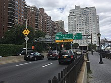
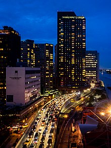
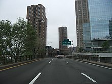
FDR Drive
FDR Drive features a mix of below-grade, at-grade, and elevated sections, as well as three partially covered tunnels.
All commercial vehicles (including trucks) are banned from FDR Drive north of exit 1.
[3] The East River Greenway runs below, beside, or above FDR Drive along nearly its entire length, except for a section between 41st and 53rd Streets.
[4] A plaque dedicating the East River Drive is visible on the southbound roadway before entering the Gracie Mansion tunnel at 90th Street.
FDR Drive starts at the southern tip of Manhattan at South and Whitehall Streets in the Financial District.
[5] FDR Drive continues north through Lower East Side and Alphabet City, and dips under Houston Street at exit 5, in a three-way interchange.
FDR Drive dips onto street level and merges with the northbound service road.
[5] The headquarters of the United Nations was constructed on a platform above at-grade FDR Drive from 42nd to 48th Streets.
[5] This section is often referred to as the United Nations Tunnel, even though only the westernmost lane of the northbound roadway is under the structure.
[5] As part of the design in this area, numerous homes on the river were demolished and rebuilt or otherwise modified to accommodate the highway.
[5] The promenade of Carl Schurz Park was built over the highway in 1939, near Gracie Mansion, the New York City mayor's residence.
Moses faced the difficulties of building a parkway/boulevard combination along the East River while minimizing disruptions to residents.
Many property owners along the East River Drive, especially in Midtown, opposed the boulevard unless noise mitigation measures were added.
[19] On June 29, 1942, a plaque commemorating the use of rubble was dedicated by Mayor Fiorello LaGuardia,[20] and is currently installed at the Waterside Plaza complex.
[22] Construction of this segment required modifications to the elevators and underground carriers that transported coal and ash between barges docked in the East River and the Waterside Generating Station and Kips Bay Steam Plant.
[25] Only a few years after its oldest stretches opened, city officials began planning to upgrade the parkway into an expressway.
At-grade intersections would be eliminated on certain portions, while others would be replaced by new concrete viaducts, and others would be capped as tunnels.
[32] In 1965, plans were announced for direct ramps to the Brooklyn Bridge, this would eliminate congestion at its approach by relocating traffic onto the expressway.
[35] In 1971, plans to reconstruct the portion of the South Street Viaduct between its southern end and exit 2 as an extension of the Battery Park Underpass were announced.
[2] Exit 6, an at-grade interchange which connected to at 15th Street, passed through a ConEdison substation, which handles most of the electricity for Lower Manhattan.
It was permanently closed after the September 11 attacks when city and ConEdison officials concluded it was too risky to allow such easy access to such a critical piece of infrastructure.
[5] In 2002, a project to improve safety from East 63rd Street to the southern terminus at the Triborough Bridge was completed.
[2] In November 2005, as part of the reconstruction of NY 9A, the western end of the Battery Park Underpass was extended to the north by about 25 feet (7.6 m).
[43] In September 2023, plans were announced by Manhattan borough president Mark Levine to replace the South Street Viaduct with an urban boulevard.
[44] As stated by Levine, it "is the least heavily used part of the FDR and it has created a noisy uglier barrier between the people of lower Manhattan and their waterfront".