Interstate 87 (New York)
From there, the route runs northward through the Hudson Valley, the Capital District, and the easternmost part of the North Country to the Canada–United States border in the town of Champlain.
North of Albany, I-87 follows the Adirondack Northway, a highway built in stages between 1957 and 1967 (finished just in time to bring Americans to the World Exhibition held in Montreal that year).
Early proposals for I-87 called for the route to take a more easterly course through the Hudson Valley and extreme southwestern Connecticut between New York City and Newburgh.
It passes by Yankee Stadium on its way to Highbridge, where the Deegan connects to the Cross Bronx Expressway (I-95 and US Route 1 [US 1]) at the eastern approach to the Alexander Hamilton Bridge.
The Deegan remains in close proximity to the Harlem River until the waterway turns westward at Kingsbridge to form the northern edge of Manhattan.
[5] North of Kingsbridge, the expressway follows a generally northeasterly alignment, passing through the center of Van Cortlandt Park as it connects to Mosholu Parkway and Jerome Avenue.
The Thruway continues generally westward to Suffern, where I-87 and I-287 split at a large semi-directional T interchange (exit 15) only about a half mile (0.80 km) from the New Jersey border.
[8] The Northway, the part of Interstate 87 (I-87) north of the New York State Thruway, was built in segments, which became I-87 as they were completed and linked to the pre-existing route.
It immediately traverses the Albany Pine Bush Preserve and passes west of Rensselaer Lake before crossing CSX Transportation's Hudson Subdivision and running parallel to Wolf Road, a business thoroughfare through the town of Colonie.
Heading northbound, the ramp for exit 2E feeds directly into the intersection of NY 5 and Wolf Road, located just west of Colonie Center, one of the Capital District's largest enclosed shopping malls.
NY 7 joins I-87 here, following the freeway for roughly 0.8 miles (1.3 km) to exit 7, the west end of a limited-access highway previously known locally as Alternate Route 7.
While NY 7 heads east toward Troy, I-87 continues north past gradually less commercialized areas as it approaches the northern county line.
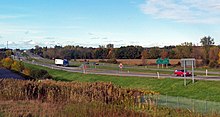
The highway continues around the eastern edge of Saratoga Springs to exit 15, where the relatively undeveloped areas east of I-87 are briefly replaced by Wilton's commercial district along NY 50.
Past exit 20, I-87 runs across increasingly remote areas of Queensbury as the road enters Adirondack Park and heads toward Lake George.
While US 9 heads northwest into the Warrensburg to connect to NY 28, I-87 turns northward to follow the east bank of the Schroon River for 17 miles (27 km) through a deep, remote valley.
Here, US 9 and I-87 cross paths again, with the former heading northwest toward Keene and the latter continuing northeast in a narrow valley formed by Ash Craft Brook.
After five miles (8.0 km), the stream reaches its source at Lincoln Pond, leaving the Northway to climb in elevation and wind its way northeastward across the surrounding mountains.
From here, the highway takes a generally northerly track across the Boquet River to the town of Lewis, rejoining US 9 as both roads head toward Clinton County.
Beyond NY 9N, the Northway curves to the north, running along the west side of Keeseville before entering another rural but fairly level stretch that follows I-87 out of Adirondack Park.
Just inside the town line, the Northway crosses over the Salmon River and intersects NY 22 at exit 36, a junction serving nearby Plattsburgh International Airport.
Continuing away from the junction, I-87 comes within one mile (1.6 km) of Lake Champlain as it follows US 9 away from Plattsburgh and northward across open, rolling fields in the towns of Beekmantown and Chazy.
[5] I-87 takes a northerly track from US 11, crossing the Chazy River and briefly entering the village limits, where it runs past a series of homes and businesses built up along nearby US 9.
From Newburgh to the Elmsford area, I-87 was to follow a new highway running parallel to US 9 northward along the eastern bank of the Hudson River to Fishkill.
After the Hudson River Expressway proposal was cancelled in the 1960s, the alignment of I-87 was shifted farther east to follow a newly completed freeway in the Route 22 corridor that started at I-287 in White Plains, then cut north through the extreme southwest corner of Connecticut before reentering New York and reaching I-84 at Brewster.
In 1970, the I-87 designation was shifted to the New York State Thruway between Newburgh and the Deegan Expressway; its previous alignment between Brewster and White Plains was redesignated as I-684.
[24] When the Latham–Malta segment was opened, it featured one of the few railroad grade crossings on an Interstate Highway, just south of the Thaddeus Kosciusko Bridge over the Mohawk River.
[39] The Federal Highway Administration (FHWA) issued a report in October 2011 designating the Tappan Zee's replacement to be a dual-span twin bridge.
[49] The renaming resulted in controversy from the public who wanted to keep the name to honor Tappan Indians and Dutch who previously resided in the area.
In 2007, a driver who crashed off the road was unable to summon help, prompting messages from local governments to telephone companies to add new wireless towers to address the problem and warning signs to inform travelers of the so-called "dark zone".
These boxes used a two-way ultra high frequency radio network to connect directly to New York State Police dispatchers.