List of Farm to Market Roads in Texas (500–599)
[6] It then travels eastward and then northeastward before reaching its eastern terminus at FM 580 southwest of Bend, for a total length of 35.6 miles (57.3 km).
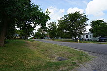
Ranch to Market Road 505 (RM 505) lies entirely within Jeff Davis County in the Trans-Pecos region of far West Texas.
Intended to provide a link between the county's only two incorporated areas, Valentine and Fort Davis, RM 505 begins at a junction with US 90 south of Valentine and travels about 8.8 miles (14.2 km) east to an intersection with SH 166 approximately 22 miles (35 km) west of Fort Davis.
US 77 in Sebastian, and also serves the towns of La Feria, where the highway intersects I-2/US 83, and Santa Rosa, where it runs concurrent with SH 107.
It runs from FM 508 to the Los Indios Texas Port of Entry near the Free Trade International Bridge along the Mexican border.
On November 20, 2014, the road was extended east 0.4 miles (0.64 km) to a then-proposed Border State Inspection Facility.
The designation of the section previously transferred to UR 509 reverted to FM 509 with the elimination of the Urban Road system on November 15, 2018.
On October 26, 1954, the road was extended 17.2 miles (27.7 km) to US 83 (now East Stenger Street) southeast of San Benito, replacing a section of FM 732.
FM 516 was designated on June 11, 1945, as Ranch to Market Road 516 (RM 516), running from Barstow to a point 8.7 miles (14.0 km) northwest.
[42][43][44] FM 526 was designated on June 21, 1941, as a spur from US 90 northeast of Houston south 6 miles (9.7 km) to the Market Street Road.
Farm to Market Road 534 (FM 534) is located in Bee, Live Oak, and Jim Wells counties.
A previous route numbered FM 534 was designated on July 9, 1945, from US 77 at Spur 27 to a point 3 miles (4.8 km) north.
[83] On August 31, 2000, the section of FM 544 from SH 78 to the Dallas County line was removed from the state highway system and given to the city of Wylie.
Farm to Market Road 548 (FM 548) is located in Kaufman and Rockwall counties in the eastern portion of the Dallas–Fort Worth metroplex.
The highway turns back to the northeast at Marketplace Drive, the location of a major shopping center in the town.
A previous route numbered FM 553 was designated on July 13, 1945, from SH 154, 1 mile (1.6 km) west of Gilmer, northwest to Enon.
A previous route numbered FM 554 was designated on July 13, 1945, from SH 154 just west of Gilmer southwest to Latch.
FM 561 was designated on July 9, 1945, from SH 26 (now US 259), 2 miles (3.2 km) south of De Kalb, to College Hill and beyond, then east via Siloam to Simms.
On September 27, 1960, the road was extended 4 miles (6.4 km) south from SH 61 (this section was originally planned as a rerouted FM 564).
Construction on the new road was completed by April 10, 1965, when FM 564 was removed from the state highway system; it is now Main Street.
FM 580 was designated on July 11, 1945, from US 190 in Lampasas west to Ogles Road (3 miles (4.8 km) east of Nix).
A previous route numbered FM 582 was designated on July 14, 1945, from US 190 in Lampasas northeast 8.0 miles (12.9 km) to the Copperas Cove Road.
The original FM 584 was designated on July 16, 1945 from US 84 in Zephyr northeast 3.5 miles (5.6 km) to a road near Dry Blanket Creek in Brown County.
The highway originally ran from its junction with US 84 northward approximately 6.5 miles (10.5 km) to the road connecting the communities of Thrifty and Fry (present-day FM 2492).
The route reached its current length on May 24, 1962, when it was extended northward and westward to connect with SH 206, replacing FM 2560.
FM 586 was designated on July 16, 1945, from US 281 (now US 377) at Dulin (16 miles (26 km) southwest of Brownwood) via Brooksmith to the East and West Road.
FM 588 was designated on July 13, 1945, from SH 36, 8.5 miles (13.7 km) northwest of Comanche, to the southern edge of Beattie.
FM 590 was designated on July 13, 1945, from SH 16 near the southern edge of Comanche to Blanket Road (4.5 miles (7.2 km) north of Mercer's Store).
On December 18, 1951 (connecting section designated November 20), the road was extended 12.6 miles (20.3 km) to US 84 in Zephyr, replacing FM 584.
The next use of the FM 594 designation was in Floyd County, from US 70 in Floydada east 0.9 miles (1.4 km) along Price Street to SH 207.