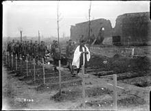
First Battle of Passchendaele
The British had planned to capture the ridges south and east of the city of Ypres as part of a strategy decided by the Allies at conferences in November 1916 and May 1917.
Passchendaele lay on the last ridge east of Ypres, 5 mi (8.0 km) from the railway junction at Roulers, which was an important part of the supply system of the German 4th Army.
The remaining guns were either left in old positions and fired at the limit of their range or were operated from any flat ground near wooden roadways or from platforms, many of which were unstable, where it was found impossible to move them forward.
General Herbert Plumer and Field Marshal Douglas Haig were left under the impression that a big advance had been made towards Passchendaele ridge but most of the ground had been lost to German counter-attacks in the afternoon.
[8] Had the German defence collapsed during the Battle of Poelcappelle on 9 October, the reserve brigades of II Anzac Corps were to have passed through later in the day, to advance to far side of Passchendaele village and the Goudberg spur to the north.
[13] The Battle of Poelcappelle began on 9 October and was costly to both sides; most of the ground captured opposite Passchendaele was lost later in the day to German counter-attacks.
[14] News of this German defensive success was slow in reaching the higher British commanders, because the usual collapse of communications during an attack was exacerbated by the rain and mud.
Patrols discovered that the 49th (West Riding) Division had reached the Wallemolen spur east of the Ravebeek creek but the advance beyond had been stopped by new barbed wire entanglements around the Flandern I Stellung.
[22] Plumer discovered that the line near Passchendaele had hardly changed and that the main reason for the failure on 9 October was uncut barbed wire 30 yd (27 m) deep, in front of the pillboxes at the hamlet of Bellevue on the Wallemolen spur.
[23] The New Zealand Division commander, Major-General Andrew Russell, later wrote that accurate information had arrived 24 hours too late to ask for a postponement or radically to alter the barrage plan and unit orders.
The division had the nominal support of a hundred and forty-four 18-pounder field guns and forty-eight 4.5-inch howitzers The artillery was expected to move forward after the final objective was gained, to bombard German-held ground from positions 1,000–2,000 yd (910–1,830 m) beyond Passchendaele village.
Outposts beyond the German advanced defensive zone (Vorfeld) were to hold the front line in enough strength to stop the British from sapping forward.
[39] In his diary, Rupprecht wrote that he was doubtful about the changes of tactics required by Ludendorff, especially his instructions for more counter-battery fire, since in previous battles the German artillery had engaged British infantry.
[44] The New Zealand advance was obstructed by uncut barbed wire on the Wallemolen spur; the creeping barrage was very thin, as some guns were bogged and others had been knocked out by German artillery.
The creeping barrage diminished as it moved forward and howitzer shells, plunging into wet ground around the Bellevue pillboxes exploded harmlessly.
North of the Gravenstafel–Metcheele road, the division gained some ground but was stopped by belts of barbed wire 25–50 yd (23–46 m) deep and were swept by machine-gun fire.
[48] The 9th (Scottish) Division was hampered by the effect of rain and mud on supply routes, which stranded guns and caused shortages of ammunition, particularly in smoke shells.
The advancing troops lost direction and communication broke down, as carrier pigeons were hindered by the high wind and messenger dog handlers became casualties.
On the left of the brigade the ground was even worse, the infantry were unable to keep up with the barrage and lost direction but managed to capture a pillbox and move forward.
Mud clogged weapons of all types and at 11:00 a.m., a British trench-mortar battery and some supporting machine-guns had to cease fire, because of wet and dirty ammunition.
The left-hand battalion advance faced less opposition and by 6:20 a.m. had crossed the Poelcappelle–le Cinq Chemins road, captured Memling and Senegal farms and then made contact with the 17th (Northern) Division.
After the capture of Requette Farm by the right-hand battalion, more German machine-gun fire was received from the Brewery and Helles House, which stopped the attack on the right flank.
Beyond the railway, the advance of the 51st Brigade veered slightly south, away from a German strongpoint which caused many casualties and lost touch with the Guards Division.
South of the embankment, astride the Broombeek and Watervlietbeek streams, several German farm strongpoints, pillboxes and shell-hole positions were overrun by the infantry, who were able to keep well up to the very-slow-moving barrage.
[55] In cold, wet weather, the 3rd Guards Brigade made a short advance behind a ragged barrage, took the higher ground on the edge of Houthoulst Forest and cut off the rest of the spur running north-east from Veldhoek.
The fresh troops patrolled vigorously to the southern edge of Houthoulst Forest against little organised German resistance, except for extensive sniping around the Colbert cross-roads and Colombo House.
The German command considered the Allied advance in the north to be less dangerous than that towards the Flandern II Stellung defensive position between Passchendaele and Drogenbroodhoek.
[60] Ludendorff changed his mind about the prospect of retaining Passchendaele Ridge, believing that the British had only fourteen days before the weather made attacks impossible and ordered Rupprecht to stand fast.
[9] On 13 October, the British decided to stop the offensive until better weather returned and roads and tracks had been repaired, to ensure that deliberate attacks with a greater quantity of artillery support could be resumed.
Attacking on ground cut up by bombardments and soaked by rain, the British had struggled to advance in places and lost the ability to move quickly to outflank pillboxes.