Florida's Turnpike
The turnpike runs through Miami, Fort Lauderdale, and West Palm Beach, where it parallels I-95, and through Orlando, where it crosses I-4.
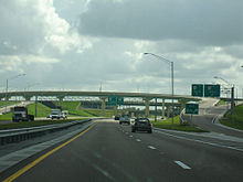
[2] The main section of Florida's Turnpike begins at the northern end of the Golden Glades Interchange in Miami Gardens as a six-lane highway, and passes through the Golden Glades Toll Barrier, a cashless toll point, similar to the ones on the HEFT.
In Davie, about 8 miles (13 km) north of the Homestead Extension interchange, it intersects with I-595, providing direct access to Alligator Alley and Ft. Lauderdale International Airport.
Still in Pompano Beach, it has a northbound-only exit (and southbound-only entrance) at Atlantic Boulevard (SR 814), followed by full interchanges with Coconut Creek Parkway/Dr.
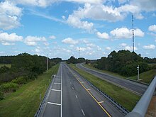
North of exit 69, the road is no longer illuminated by streetlights but rather only at interchanges, near service plazas, and some urban areas (like near Orlando).
Between Fort Pierce and Yeehaw Junction, the turnpike travels in a nearly east-west direction heading inland, with a 40.5-mile (65.2 km) gap between the two exits, the second longest of any US expressway.
[7] It then passes exit 240 located at Clay Whaley Road, a partial interchange featuring a northbound on- and southbound off-ramp only.
[3][5] After passing the I-4 interchange (exit 259) near many of Orlando's theme parks, connecting directly with the I-4 express lanes to and from the east along I-4, the Turnpike moves in a northwest direction, first passing by the Turkey Lake Service Plaza at mile marker 263, where the FDOT district headquarters of the Turnpike are located.
The Turnpike then enters Lake County, heading in a northwestern direction, where hilly countryside becomes a part of the terrain for the remainder of the expressway while intersecting with Hancock Road (exit 278) in Minneola, an electronic toll interchange.
[12] Additional projects to convert the turnpike to an electronic collection system were completed between I-595 and Lantana in 2019, and from SR 429 north to I-75 in Wildwood in 2020.
[17] SunPass transponders are available at the gift shop and gas stations at all service plazas, as well as Walgreens, Publix, and CVS stores statewide.
All eight plazas are open 24 hours a day and located on the center median of the turnpike for access from both directions and offer gasoline, diesel fuel, internet access, travel and tourism info and tickets, picnic areas, TV news, gift shops offering Florida Lottery, family-friendly restrooms, and pay phones.
[25][26] Since then, the Venezuelan government, under President Hugo Chávez, nationalized Citgo, and in 2006, political controversy resulted in a movement to remove the brand from the turnpike.
[31] Florida's Turnpike Enterprise operates with intelligent transportation systems (ITS), used to detect and manage incidents on their roadways.
The system, consisting of closed-circuit television traffic cameras, dynamic message signs, highway advisory radio, and radar vehicle detection system, allow the TMC to see anything from congestion to crashes, to disabled vehicles that may pose a threat to the Turnpike's motorists.
[32][33] The Road Rangers Safety Patrol offers free roadside assistance on Florida's Turnpike mainline and Homestead Extension.
[34] Utility and tow trucks patrol 12 designated zones looking for stranded motorists to provide services such as fuel, tire changes, and use of a cellular phone; and also watching out for crashes and road debris.
In the years following World War II, Florida was experiencing unprecedented growth in population and tourism, along with a revitalized citrus industry recovering from a harsh freeze early in the decade; the increased traffic load quickly burdened the state's highway system.
Only four votes against the turnpike were entered at the end of the session's roll call, and the Legislature granted permission to build with a $70 million bond issue in June 1955.
[36] In October 1956, all work on the Sunshine State Parkway north of Ft. Pierce was abandoned and plans for a state-long turnpike were shelved due to passage of the National Interstate and Defense Highways Act, which provided for construction of limited-access highways in the corridors that had been under study for the Parkway Extension.
One was Interstate 95, which was slated to connect Jacksonville with Miami in a similar alignment to the planned Sunshine State Parkway Coastal Route.
This resulted in completion of a truncated 110-mile (180 km) highway that ran from Miami to Fort Pierce, opening on January 25, 1957.
In late May 1959, the board authorized a study for the Parkway Extension to Orlando, and connecting the Interstate routes in Florida.
[37] Waldron received a tip about excessive spending by John Hammer, chairman of the Florida Turnpike Authority, which included expensive hotels and meals, corsages for his secretary and overcharging for a chartered plane.
[45][46] In the mid-1960s, the State Road Department authorized traffic counts be conducted to determine if the separation of Interstate 95 from the Turnpike was feasible, with arguments that using a concurrent alignment was costing Florida money for federal highway funding, but not without the concern of losing toll revenue.
The results of the studies came in December 1968, but due to an uncertain bond market and an unknown future for the toll authority, decisions on the roads were delayed.
[43][51][52] In 1988, the Office of Florida's Turnpike was formed, with $220 million worth of revenue bonds being sold in April 1989 to renovate the toll plazas, service centers and improve the road with the reduction of urban congestion.
As a result, the toll rates on roads on Florida's Turnpike Enterprise were raised on June 24, 2012, an increase of 11.7% to reflect the previous five years.
However, a combination of a low inflation rate and problems within the relevant state authorities caused multiple cancellations and changes in schedule for the next increase.
[citation needed] The Turnpike Enterprise is also studying a possible developer-funded future interchange at County Road 468 (mile marker 300, servicing The Villages and Lady Lake).